Tomer’s Take:
- Pattern change remains possible on/after 10/23 across the West.
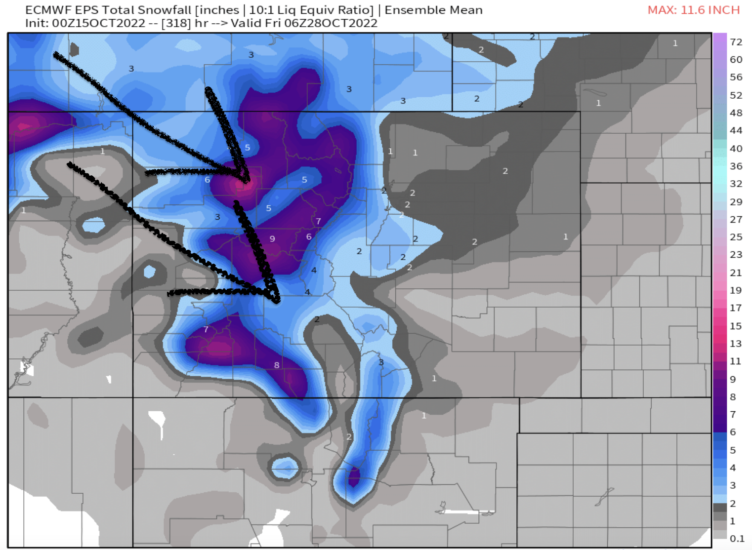
- Beneficiaries: CO, UT, WY, ID, MT, PNW, Banff.
- Lower atmospheric pressures replace high pressure ridge.
- Snow and colder temps = net result.
- If this verifies it would be the first significant snowfall of the season for much of the Intermountain West.
Current Setup
Infrared satellite shows the dominant high pressure ridge across the West. Notice the train of low pressure systems further West including the larger low rotating through Alaska. That is the start of what will gradually break down/dislodge the big high.

Pattern Flip
Forecast mid-atmospheric pressure data suggests a complete pattern change on/after 10/23 through 10/27.

Some additional variety looking down the road. The Pacific North American Pattern (PNA) turns negative on/after 10/23 suggesting a pressure change across the West. The signal has been inconsistent on the Global Forecast System but is now back to negative.

Forecast
The Global Forecast System has been inconsistent the last few days but has now flipped back to optimistic for snowfall on/after 10/23. Questions remain – such as how deep will the trough go? Where is the axis? How much cold air? How strong of a jet stream? And of course, duration.

Another perspective with different guidance. Snow possible on/after 10/23 through 10/27. Again, if this verifies it would be first significant snowfall for much of the Intermountain West.
