Tomer’s Take: Persistent trough is king out West, and this might foreshadow what to expect this El Nino driven Winter. The seasonal Monsoon was three weeks late and intensity was disrupted. It was a victim of larger scale pattern. Lower atmospheric pressures dominate the West Coast through the end of August and then transition into the Intermountain West 9/1-9/15. Monsoonal moisture gets drawn into the flow as a contributor potentially through 9/15.
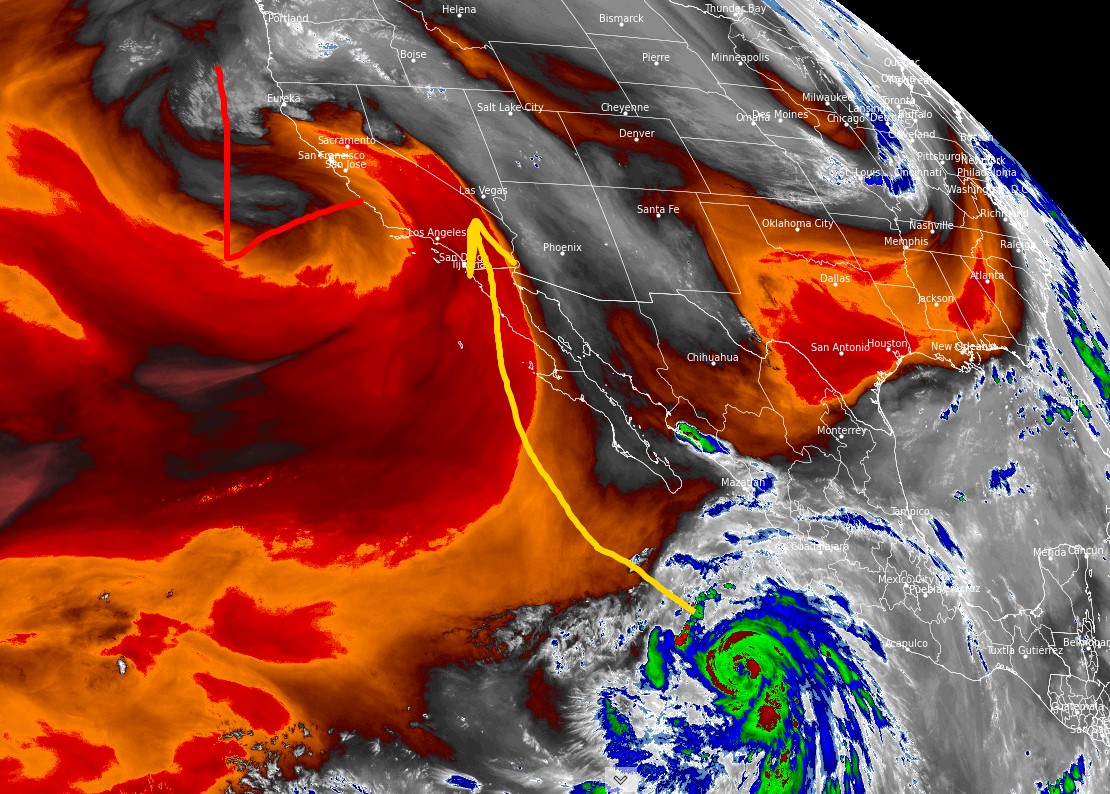
Let’s look at Hurricane Hilary. The atmospheric flow pulls this storm system into California and merges it with an area of low pressure currently off the West Coast.

Bath Water – SST’s
Below are 1-day sea surface temperature anomalies valid 8/7/2023 compared to 30-year climatology. Red/orange = warmer than normal. Sea surface temps remain warmer than normal near the Baja, PNW, Gulf, and Atlantic. This feeds tropical development and can affect regional flow.

Pattern Supports Lower Pressures
Below are forecast atmospheric pressure anomalies valid 8/19-8/20. Notice Hilary merging with an area of low pressure. The jet stream buckles and captures both.

Below is forecast total rainfall by late 8/21. Heavy rainfall and thunderstorms are likely from the Hilary/Low combo. An isolated 8-10 inch rainfall total possible in CA.
But, this moisture also hits ID, MT, SW UT, AZ, NV, and OR. Some Monsoonal moisture also gets drawn north and affects UT, CO, WY.

End of August
Below is the Global Forecast System forecast atmospheric pressure anomalies valid 8/29. The persistent trough remains off the West Coast. Also, notice another tropical system is forecast near the Baja.
This keeps some Monsoonal contribution in place for CO, WY, UT, NM.

September 1-15
Below, the Climate Forecast System moves the persistent trough eastward into the Intermountain West. The green represents above normal precipitation totals.
Areas in green receive their precipitation contribution from the Monsoon and an active jet stream.
This also indicates that the Monsoon stays later than normal. Typically, the Monsoon shuts down by September 1.

Below are forecast temperature anomalies for the same period (9/1-9/15). Heavier precipitation would keep temps cooler than normal (in blue) over the Intermountain West.

Bottom Line
Active Western pattern 8/20-9/10 with persistent Western Trough transitioning into the Rockies, Monsoonal moisture, and current/future tropical systems sucked into the flow (like Hilary).
In Colorado, September normally turns drier with the Monsoon shutting down, but that might not be the case this time around. WY, MT, UT, NM, AZ might be in the same boat.
Great stuff Chris! Exactly what I like to hear!
Thanks, Mitchell!
Thanks Chris, I was about to give up on the monsoon.
Thanks, Ralph!
Thanks Chris!
Thanks for stopping by, Brad!