Tomer’s Take: I’m forecasting above normal early to mid June precipitation for most of the West with a powerful Subtropical Jet Stream. But, what above mid to late June? Data points to drier air for a few states including CO, WY, NM, AZ.
Rich Flow with Subtropical Jet
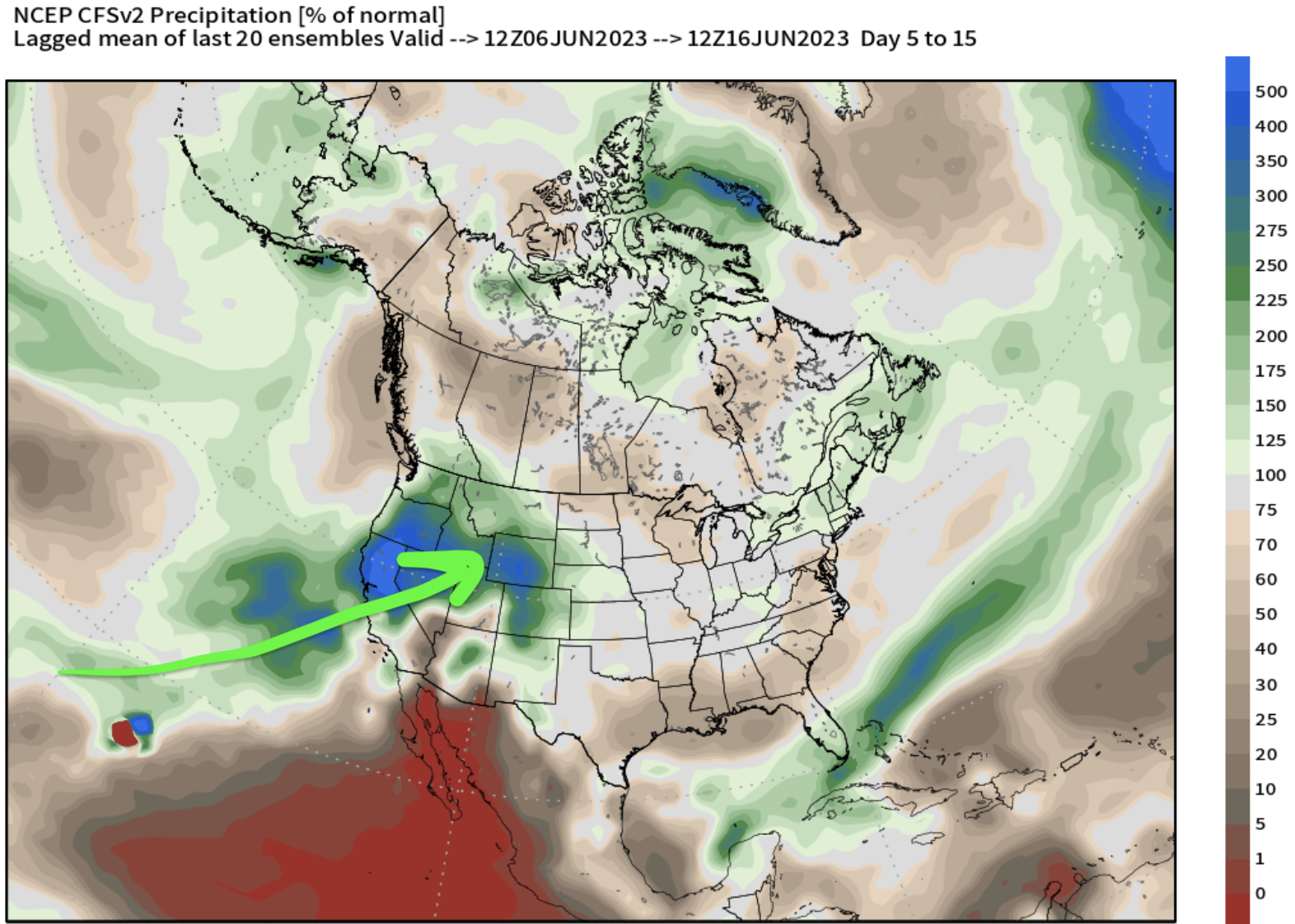
Valid 6/10: This is not normal for June. This reminds me of the powerful Atmospheric River pattern we saw over the Winter. What you’re seeing is an active and strong Subtropical Jet Stream ushering in rich moisture (and areas of low pressure) across the Intermountain West. This makes afternoon rain and thunderstorms more likely.

Early to Mid June Precipitation Totals
The Climate Forecast System paints a 100-400% bullseye (green and blue colors) across parts of the West. This means precipitation totals will run 100-400% above normal. This includes CA, OR, ID, WY, MT, UT, CO, and possibly NM & AZ. And yes, some light snow is possible early to mid June above 12,000ft.

Mid to Late June Precipitation
The pattern turns gradually drier (tan and brown colors) across CO, NM, AZ, and WY. The precipitation bullseye backs West and stays prominent in CA, OR, NV, and parts of UT.

Conclusion
What does this ultimately mean? Anyone recreating at high elevations needs to pay close attention to midday/afternoon thunderstorms with lightning and heavy downpours. Also, heavy rain each afternoon will add to snowpack snowmelt flowing into rivers and streams.
Curious.
Is the Triple Dip responsible for this?
Was the Triple Dip responsible for the wild winter weather?
Thanks
Hi Byron –
The Triple Dip played into the Winter but it went above and beyond my wildest expectations – especially the month-long atmospheric river part. Now, we’re pushing hard into El Nino. I believe the quick transition from La Nina into El Nino is partly responsible for this wet pattern. Chris