Looking back at Winter 2021-2022

Tomer’s Take:

  • Winter started late in many areas with warm/dry weather through most of November and early December.
  • December ended strong in the Sierra and across the Intermountain West with a few moderate to strong atmospheric river (AR) setups.
  • These AR’s hit parts of Colorado hard including above normal snowfall (100″) in Crested Butte.
  • Then the storm track changed and the flow dried up.
  • April delivered one last surge of snow to many places that were in desperate need.
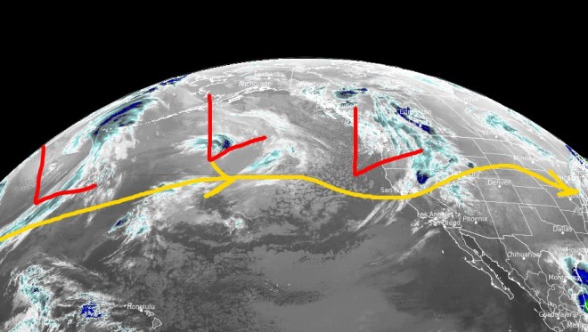
  • April also brought a 100-150mph jet stream that followed La Nina architecture and sat over the Intermountain West for 3 weeks. Abnormally strong winds prevailed.

Forecast vs Reality

Here is the Winter forecast I published in August/September 2021.

Tomer winter forecast 2021-2022.

Here are the preliminary season totals for comparison.

Winter 2021-2022 preliminary snow totals.

There were hits and misses. A few highlights:

  • Hit: Below normal snowfall Sierra Mountains
  • Hit: Below normal snowfall Colorado’s Southern Mountains
  • Hit & Miss: Normal snowfall across parts (not all) of Colorado’s Central and Northern Mountains
  • Hit: Above normal snowfall across parts of the PNW
  • Miss: I predicted normal snowfall across the Wasatch
  • Worst Miss: I predicted above normal snowfall in the Tetons
  • Miss: I predicted normal snowfall across Colorado’s Front Range ski areas

A few specifics, snowfall in inches:

LocationActualNormal
Loveland260422
Alta440530
Wolf Creek385430
Steamboat249314
Crested Butte234234
Jackson Hole334526
Park City194355
Snowfall in inches.

Thanks to everyone who read and subscribed to this Blog!

Colorado backcountry skiing 2022.

Season totals, strong wind, and active early May pattern

Tomer’s Take:

  • The storm track continues to favor the West with a few storm systems lined-up through 5/5.
  • The proximity of the jet stream through 5/5 keeps strong wind in the forecast.

Infrared satellite shows the active storm track and storm systems over the Pacific.

Infrared satellite 4/26/2022 6am.

Season Totals 2021-2022

Season Totals 2021-2022.

A few highlights:

  • Alta 440″
  • Wolf Creek 385″
  • Sunshine Village 339″
  • Jackson Hole 334″
  • Winter Park 312″
  • Vail 264″
  • Loveland 262″
  • Steamboat 249″
  • Telluride 246″
  • Crested Butte 234″
  • Park City 194″

Early May

An active jet stream and lower pressures appear to dominate the West through 5/5. If this plays out then the odds of rain/snow in mountainous areas stays high.

Forecast pressure anomalies valid early May 2022, GFS interpretation.

Wind Gust Forecast

In Colorado, the last three weeks have been one for the books. The proximity of the jet stream has followed La Nina architecture. The latest forecasts keep La Nina going strong through Spring into Summer.

Gust (MPH)4/264/274/284/294/30
Crestone Peak6060407055
Quandary Peak3535255040
Kings Peak4545504525
Wheeler Peak4045306040
Mount Whitney3525453030
Grand Teton4535354020

Snow Forecast

4/26-4/30:

Inches of total snow 4/26-4/30.

5/1-5/5:

Inches of total snow 5/1-5/5.

Colorado Dust Storm on 4/22: One for the books

Tomer’s Take:

  • Friday 4/22/2022 was a day for the books. Wildfire danger hit “Very Extreme” for the first time in a decade.
  • Dewpoint and relative humidity values dropped into the single digits.
  • Record high of 89 in Denver. All-time April record is 90.
  • A major dust storm developed as wind gusts reached hurricane force for 5 hours in some places. This was essentially a Dust Hurricane.
  • A layer of dust was deposited on Colorado’s high mountain snowpack. This will have important Spring melt implications.
  • The jet stream has taken up residence in Colorado for the last 3 weeks. On 4/22 it delivered with 100mph winds aloft.

Look at this monster low pressure, 980mb on 4/23 at 11am. It extends from Canada to the Mexico border.

Infrared satellite 4/23/2022 11am.

Below is a visible satellite image (True Color VIIRS) and aerosol depth algorithm overlay (MODIS) from 4/22 afternoon. It’s used to estimate atmospheric aerosols – in this case it’s mostly dust and smoke represented in the yellow/orange/red colors.

This dust also reached the high mountain snowpack. Atmospheric flow through 14,000ft was consistent out of the southwest all afternoon.

This dust layer will accelerate the Spring melt.

For more background, I co-authored a paper in the NWA Journal of Operational Meteorology in 2010 on dirty snow/dust storms in Colorado.

Visible satellite and AOD overlay from 4/22/2022 afternoon. Dust/smoke/aerosols represented in yellow/orange/red colors.

Photo of the dust on Vail’s Back Bowls from Patrick McCarthy:

Max Gusts 4/22

  • 10-Mile Range: 70mph
  • Red Mountain Pass: 86mph
  • Monarch Mountain: 72mph
  • Wolf Creek Pass: 71mph
  • West Elks: 60mph+
  • Sangre De Cristo High Peaks: 90mph (estimate)
  • Rocky Flats: 90mph
  • NE Plains, Otis: 86mph
  • Buckley AFB: 74mph
  • Buena Vista: 72mph
  • Air Force Academy: 71mph

Below, wind history from Breckenridge Peak 8 on the 10-Mile Range, 12,998ft. Notice three straight days of 60mph+ wind gusts.

Peak 8 of the 10-Mile Range, Wind History 4/2022.

Dust Storm

Here’s video from my colleague Courtney Fromm:

Severe Weather CO/KS

My good friend Ryan Kushner went storm chasing on 4/22. He didn’t see any tornadoes (there were several reported in KS) but says they saw a big lightning show. He says blowing dust was a major problem.

Ryan Kushner and Jenn Mravich at Mount Sunflower, KS.

Weekend snow and wind

Tomer’s Take:

  • Major storm system continues across the West through 4/24 with strong wind and heavy snow at higher elevations. Then the storm track shifts and favors the PNW through the end of April
  • A storm system with snow tracks across MT, ID, WY around April 30-May 1.

Infrared satellite shows the storm track and major low pressure system hitting California’s High Sierra with heavy snow and wind. Also notice the major low pressure in the Gulf of Alaska. It’s part of the pattern change favoring the PNW through the end of April.

Infrared satellite 4/22/2022 5am.

Wind Gust Forecast

Gust (MPH)4/224/234/24
Crestone Peak906530
Quandary Peak506020
Longs Peak407540
Kings Peak455030
Wheeler Peak656540
Mount Whitney403025

After 4/24

High pressure rebuilds across the Intermountain West. Lower pressure anomalies move into the PNW.

Forecast pressure anomalies valid 4/27/2022, GFS interpretation.

5/1

Notice the lower pressure anomalies moving through MT, WY, ID between 4/30-5/1.

Forecast pressure anomalies valid 4/30/2022.

Snow Forecast

4/22-4/24:

Inches of total snow 4/22-4/24.

4/25-5/1:

Inches of total snow 4/25-5/1.

Last gasp of April

Tomer’s Take

  • One last storm major system through 4/24 for the Intermountain West then the pattern shifts favoring the PNW.
  • Precipitation starts as rain in many mountain valleys before changing to snow.

Infrared satellite shows the storm track and large Pacific storm system moving into California. The 2nd Pacific storm system takes a more northern track into the Gulf of Alaska and is part of the pattern change next week.

Infrared satellite 4/21/2022 5am.

Next Week

High pressure rebuilds next week across the Intermountain West. Lower pressure anomalies move to the PNW.

Forecast pressure anomalies valid 4/27/2022, GFS interpretation.

Wind Gust Forecast

Gust (MPH)4/214/224/234/24
Crestone Needle45855530
Quandary Peak35505530
Grand Teton40354030
Kings Peak55505030
Wheeler Peak35655035
Mount Whitney60453030

Snow Forecast

4/21-4/24:

Inches of total snow 4/21-4/24.

4/25-4/30:

Inches of total snow 4/25-4/30.

Snow and wind through the weekend

Tomer’s Take

  • Western storm cycle concludes with a strong, windy, and slower moving storm system.
  • High to Extreme wildfire risk precedes this storm system.
  • Wind gusts could reach 100mph with blowing dust. A dust layer is possible on the snowpack.
  • After 4/24 the pattern shifts. The storm track moves into PNW and turns more tranquil across the Intermountain West with high pressure rebuilding.

Infrared satellite shows the storm track and powerful Pacific storm system lined-up through 4/24.

Infrared satellite 4/20/2022 5am.

Wind Gust Forecast

Gust (MPH)4/204/214/224/23
Crestone Peak55459060
Quandary Peak45305555
Kings Peak35505550
Wheeler Peak50306550
Mount Whitney55605030
Grand Teton45353035

After 4/24

High pressure rebuilds across the Intermountain West. The storm track and low pressure anomalies shift to the PNW.

Forecast pressure anomalies valid 4/26/2022, GFS interpretation.

Snow Forecast

4/20-4/24:

Inches of total snow 4/20-4/24.

4/25-4/29:

Inches of total snow 4/25-4/29.

April snow keeps coming

Tomer’s Take

  • Two storm systems follow a powerful jet stream and deliver heavy snow to parts of the West through 4/24.
  • California’s UC Berkeley Central Sierra Snow Lab is reporting a few feet of snow in the last 7 days.
  • The first storm system is smaller and takes a more northern track and only brushes UT and CO.
  • The second storm is larger and hits UT and CO with bigger impacts.
  • What happens after 4/24? Pacific North American Pattern (PNA) turns neutral and the Intermountain West turns more tranquil. PNW gets most of the action.

Water vapor satellite shows the storm track hitting the West Coast and storm systems lined-up.

Water vapor satellite 4/19/2022 6am, Red/orange = drier air aloft.

Western Snowpack

We’re ending the season with an active storm track. Many places need it, badly.

NRCS Snowpack Survey (SWE).

Wind Gust Forecast

Gusts (MPH)4/194/204/214/22
Crestone Peak60605085
Quandary Peak50453545
Kings Peak50355545
Wheeler Peak60553565
Mount Whitney75406540
Grand Teton50403020

Snow Forecast

4/19-4/24:

Inches of total snow 4/19-4/24.

4/25-4/28:

Inches of total snow 4/25-4/28.

Weekend snow forecast

Tomer’s Take

  • Two storm systems roll across the West through 4/17.
  • California is finally in the storm track with 2-3 storm systems lined-up through 4/24.
  • 30-70mph wind gusts through 4/17 scrape the high peaks across the West with powerful jet stream aloft.

Infrared satellite shows the active storm track for CA and the West with storm systems lined-up through 4/24.

Infrared satellite 4/15/2022 5am.

Wind Gust Forecast

Gusts (MPH)4/154/164/17
Crestone Peak456055
Longs Peak452550
Quandary Peak454045
Kings Peak405045
Wheeler Peak455050
Mount Whitney407025
Grand Teton505555

Snow Forecast

4/15-4/17:

Inches of new snow 4/14-4/17.

4/18-4/24:

Inches of new snow 4/18-4/24.

For more analysis please watch my forecast video:

Snow forecast next 8 days

Tomer’s Take

  • Snow, wind, and cold continues through 4/17 across the West then drier.
  • 150mph jet streak with favorable WNW orientation continues forcing orographic snow across the Central and Northern Mountains of Colorado 4/14-4/15. Abnormally cold temps near zero over the high passes.
  • The pattern through 4/17 puts the brakes on the Spring Melt.
  • Pattern shifts back to active on 4/20 and after for the West Coast.

8″ new snow last 24 hours at Winter Park.

2″ new snow last 24 hours at Aspen/Snowmass.

3.5″ new snow last 24 hours at Loveland.

Below, Winter Park looking more like January than April. Air temps are in the single digits with strong ridgetop wind gusts 30-60mph.

Winter Park 4/14 6am, 20″ new in 48 hours.

Water vapor satellite shows the storm track and storm systems lined-up. Red/orange = drier air aloft.

Water vapor satellite 4/14/2022 5am.

Wind Gust Forecast

Gusts (MPH)4/144/154/16
Crestone Peak555060
Capitol Peak454550
Kings Peak454045
Grand Teton505055
Mount Whitney553565
Wheeler Peak454550

Snow Forecast

4/14-4/17:

Inches of total snow 4/14-4/17.

4/18-4/23:

Inches of total snow 4/18-4/23.

For more analysis please watch my forecast video:

April snow, wind, and cold continue

Tomer’s Take

  • Snow and wind continue in northern CA, ID, UT, WY, CO, NM through 4/15.
  • Favorable WNW jet stream orientation adds orographic enhancement.
  • Temps are below zero with strong wind in the Mountains of Colorado.
  • Next storm hits CA 4/16 then takes a more northern track with heavy snow in the PNW, ID, WY, MT, and Banff area.
  • This storm brushes the Wasatch and the Central and Northern Mountains of Colorado 4/16-4/17.

17″ new snow in the last 24 hours at Snowmass.

5″ new snow in the last 24 hours at Alta.

12″ new snow in the last 24 hours at Winter Park.

8″ new snow in the last 24 hours at Vail.

Water vapor satellite shows the WNW jet stream orientation over the Intermountain West and Pacific storm systems lined-up.

Water vapor satellite 4/13/2022 6am.

Wind Forecast

Forecast (MPH)4/134/14
Crestone Peak6555
Pyramid Peak5050
Wheeler Peak7055
Kings Peak4545
Mount Whitney5045

Snow Forecast

4/13-4/15:

Inches of total snow 4/13-4/15.

4/16-4/22:

Inches of total snow 4/16-4/22.