Tomer’s Take
- One last storm major system through 4/24 for the Intermountain West then the pattern shifts favoring the PNW.
- Precipitation starts as rain in many mountain valleys before changing to snow.
Infrared satellite shows the storm track and large Pacific storm system moving into California. The 2nd Pacific storm system takes a more northern track into the Gulf of Alaska and is part of the pattern change next week.

Next Week
High pressure rebuilds next week across the Intermountain West. Lower pressure anomalies move to the PNW.

Wind Gust Forecast
| Gust (MPH) | 4/21 | 4/22 | 4/23 | 4/24 |
| Crestone Needle | 45 | 85 | 55 | 30 |
| Quandary Peak | 35 | 50 | 55 | 30 |
| Grand Teton | 40 | 35 | 40 | 30 |
| Kings Peak | 55 | 50 | 50 | 30 |
| Wheeler Peak | 35 | 65 | 50 | 35 |
| Mount Whitney | 60 | 45 | 30 | 30 |
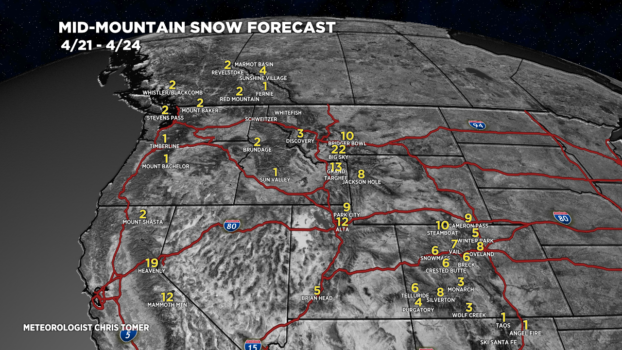
Snow Forecast
4/21-4/24:

4/25-4/30:
