Tomer’s Take
- Two storm systems follow a powerful jet stream and deliver heavy snow to parts of the West through 4/24.
- California’s UC Berkeley Central Sierra Snow Lab is reporting a few feet of snow in the last 7 days.
- The first storm system is smaller and takes a more northern track and only brushes UT and CO.
- The second storm is larger and hits UT and CO with bigger impacts.
- What happens after 4/24? Pacific North American Pattern (PNA) turns neutral and the Intermountain West turns more tranquil. PNW gets most of the action.
Water vapor satellite shows the storm track hitting the West Coast and storm systems lined-up.

Western Snowpack
We’re ending the season with an active storm track. Many places need it, badly.

Wind Gust Forecast
| Gusts (MPH) | 4/19 | 4/20 | 4/21 | 4/22 |
| Crestone Peak | 60 | 60 | 50 | 85 |
| Quandary Peak | 50 | 45 | 35 | 45 |
| Kings Peak | 50 | 35 | 55 | 45 |
| Wheeler Peak | 60 | 55 | 35 | 65 |
| Mount Whitney | 75 | 40 | 65 | 40 |
| Grand Teton | 50 | 40 | 30 | 20 |
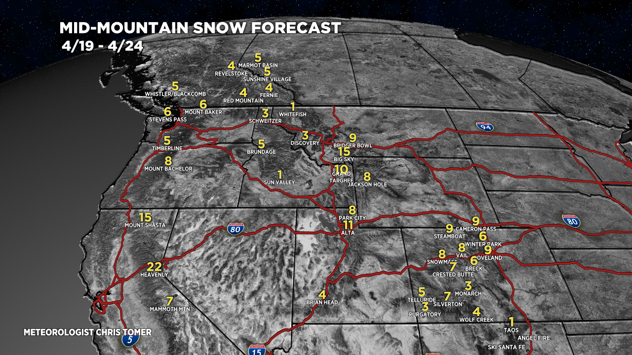
Snow Forecast
4/19-4/24:

4/25-4/28:

Thanks Chris!