Tomer’s Take:
- Major storm system continues across the West through 4/24 with strong wind and heavy snow at higher elevations. Then the storm track shifts and favors the PNW through the end of April
- A storm system with snow tracks across MT, ID, WY around April 30-May 1.
Infrared satellite shows the storm track and major low pressure system hitting California’s High Sierra with heavy snow and wind. Also notice the major low pressure in the Gulf of Alaska. It’s part of the pattern change favoring the PNW through the end of April.

Wind Gust Forecast
| Gust (MPH) | 4/22 | 4/23 | 4/24 |
| Crestone Peak | 90 | 65 | 30 |
| Quandary Peak | 50 | 60 | 20 |
| Longs Peak | 40 | 75 | 40 |
| Kings Peak | 45 | 50 | 30 |
| Wheeler Peak | 65 | 65 | 40 |
| Mount Whitney | 40 | 30 | 25 |
After 4/24
High pressure rebuilds across the Intermountain West. Lower pressure anomalies move into the PNW.

5/1
Notice the lower pressure anomalies moving through MT, WY, ID between 4/30-5/1.

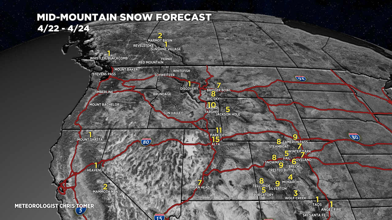
Snow Forecast
4/22-4/24:

4/25-5/1:
