Tomer’s Take
- Snow and wind continue in northern CA, ID, UT, WY, CO, NM through 4/15.
- Favorable WNW jet stream orientation adds orographic enhancement.
- Temps are below zero with strong wind in the Mountains of Colorado.
- Next storm hits CA 4/16 then takes a more northern track with heavy snow in the PNW, ID, WY, MT, and Banff area.
- This storm brushes the Wasatch and the Central and Northern Mountains of Colorado 4/16-4/17.
17″ new snow in the last 24 hours at Snowmass.
5″ new snow in the last 24 hours at Alta.
12″ new snow in the last 24 hours at Winter Park.
8″ new snow in the last 24 hours at Vail.
Water vapor satellite shows the WNW jet stream orientation over the Intermountain West and Pacific storm systems lined-up.

Wind Forecast
| Forecast (MPH) | 4/13 | 4/14 |
| Crestone Peak | 65 | 55 |
| Pyramid Peak | 50 | 50 |
| Wheeler Peak | 70 | 55 |
| Kings Peak | 45 | 45 |
| Mount Whitney | 50 | 45 |
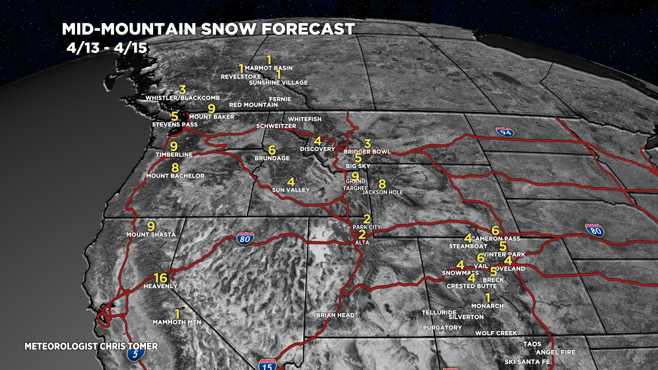
Snow Forecast
4/13-4/15:

4/16-4/22:

Hey Chris,
Where should I go hiking this weekend in Colorado?\
Thanks.
Hi Logan – are you looking for something close to Denver? Chris