Tomer’s Take:
- The final storm system of this storm cycle is currently tracking through UT, WY, CO through 11/10.
- What’s next? Storm cycle ends 11/10.
- High pressure rebuilds then a large trough of low pressure sets up shop across the West through 11/16.
- But, this trough is much drier and colder. There is a southern track low that might sneak through favoring CO/NM.
Current Setup
Infrared satellite shows the final storm system of this storm cycle tracking through UT, WY, CO.

A few snow highlights from the last 48 hours.
- Alta: 22″ (24hr), 27″ (48hr)
- Solitude: 21″/22″
- Jackson Hole: 11″/16″
- Kirkwood: 14″/27″
- Palisades Tahoe: 18″/39″
- Mammoth: 32″/49″
Looking Ahead: November 11-16
What’s next after this storm cycle? = Brief high pressure followed by a large trough of low pressure that is drier and colder.
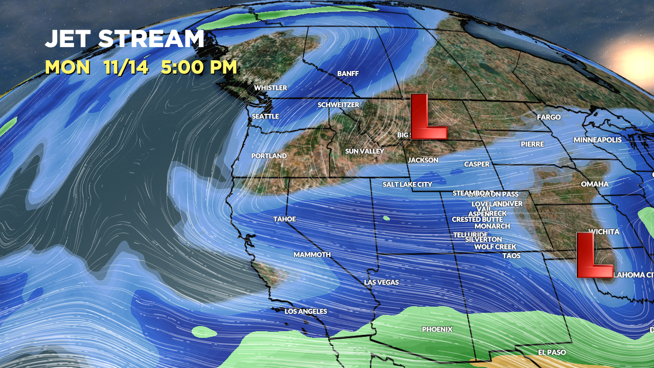
Below is the forecast jet stream flow valid 11/14/2022. This pattern does not support big, widespread snowfall. The only place(s) favored is CO/NM because of a southern track low that sneaks through.

Forecast Timing
Forecast radar/satellite valid 11/9-11/14.
Forecast Snowfall
Forecast snow totals (inches) valid 11/9-11/10.

Forecast snow totals (inches) valid 11/11-11/15.
The large trough of low pressure is drier and colder. The pattern does not support big, widespread snowfall. The only place(s) favored is/are CO/NM because of a southern track low that sneaks through.

My forecast video 11/9 with updated snow map (snow yet to fall):