Tomer’s Take: A Western pattern shift is underway as the jet gradually moves north and takes on a NW oriented flow. A deeper trough sets up in the Northeast with 2-3 different storm systems lined-up through 1/28.
My forecast video 1/19:
Current Setup
Water vapor satellite shows a shifting storm track out West. Storm systems will now be routed further north into the PNW/BC.

Forecast Pattern
Forecast jet stream valid 1/28. Notice the high pressure ridging in the Gulf of Alaska. Overall, this high will retrograde West into February 1. This opens the door for lower atmospheric pressures over more of the West.

Early February Pattern
EPS forecast atmospheric pressure anomalies (mid atmosphere) valid late 2/2. Lower pressure anomalies expand across the West.

Forecast Timing
Forecast radar/satellite valid 1/19-1/24.
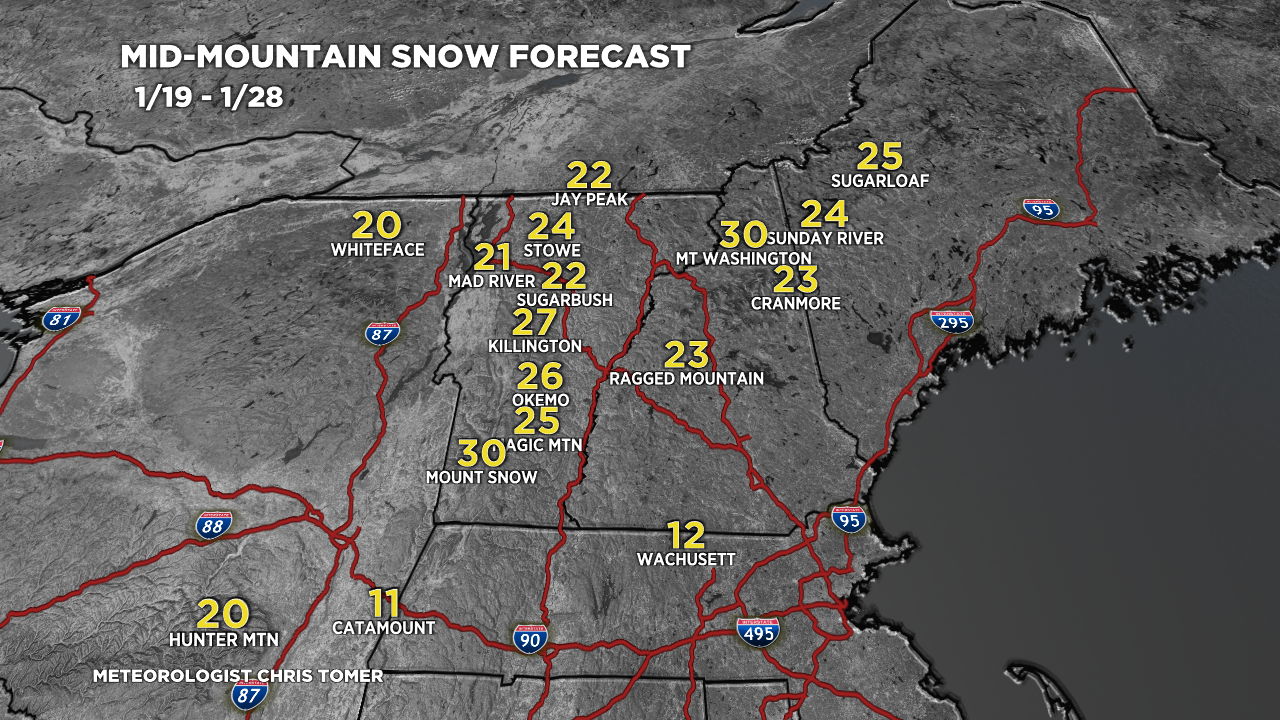
Forecast Totals
Forecast snow totals (inches) valid 1/19-1/21.

Forecast snow totals (inches) valid 1/22-1/28. NW oriented jet flow takes over. This favors BC/Banff/MT/ID/WY/CO.

Forecast snow totals (inches) valid 1/19-1/28. I added Whiteface by request.
Storm#1: 1/19-1/20
Storm#2: 1/22-1/23
Storm#3: 1/25-1/26

Thanks Chris! And thanks for adding WhiteFace!
You bet, Arthur, thanks!
Chris