Tomer’s Take: I’m forecasting three Spring storm systems for the West through 5/12. Snow accumulations at higher elevations with high snow levels. Then high pressure builds in through 5/20.
A couple inches of new snow fell high in the Wasatch. There is some additional snow in my forecast.
Wasatch Snow Timeline: late 5/5-5/7, late 5/8, late 5/10.
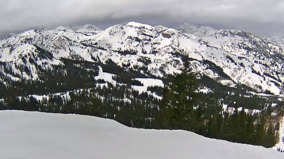
View from Brighton, UT:

Forecast Freezing Level
Wasatch, Daily Max/Min:
5/5: 9200’/7900′
5/6: 9000’/8200′
5/7: 9700’/8000′
5/8: 11000’/10000′
5/9: 11500’/10800′
Colorado’s Central Mountain Zone, Daily Max/Min:
5/5: 12000’/8900′
5/6: 12000’/8900′
5/7: 12000’/9200′
5/8: 13300’/10500′
5/9: 14000’/11500′
Forecast Wind Gusts
Quandary Peak, CO, Max Gust:
5/5: 40mph
5/6: 40mph
5/7: 35mph
5/8: 35mph
5/9: 30mph
5/10: 40mph
Longs Peak, CO:
5/5: 30mph
5/6: 45mph
5/7: 35mph
5/8: 30mph
5/9: 25mph
Mount Superior, UT:
5/5: 30mph
5/6: 30mph
5/7: 25mph
5/8: 30mph
5/9: 30mph
Forecast Pattern
Forecast jet stream valid 5/8. Notice the dip in the jet and trough of low pressure off the West Coast.

5/10: Area of low pressure slides east into UT/ID/WY/CO.

Forecast Timing
Forecast radar/satellite valid 5/5-5/10:
Forecast Totals
5/5-5/14:
