Tomer’s Take: Forecast freezing levels stay elevated. This forces the snowpack to continue melting across the West. I’m also forecasting afternoon thunderstorms almost every single day across the Intermountain West with a rich feed of moisture. Early June could be wetter than normal.
11:30am view from Vail looking East/Northeast across the Gore Range. Snow continues melting and you can see the daily thunderstorms developing.

Forecast Freezing Level
Colorado’s Central Mountains, Daily Max/Min:
5/26: 14100’/12100′
5/27: 14400’/12100′
5/28: 14100’/12500′
5/29: 14900’/13100′
Wasatch Mountains, UT:
5/26: 13000’/12300′
5/27: 12500’/11600′
5/28: 13600’/12600′
5/29: 13500’/13000′
Teton Range, WY:
5/26: 12000’/11600′
5/27: 11500’/11300′
5/28: 12300’/11000′
5/29: 13300’/12500′
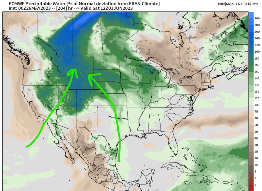
Rich Moisture Feed
Afternoon thunderstorms are likely each day through the end of May. This pattern will likely continue into early June and of course July-August.
In addition, we’re seeing extra moisture flood the atmosphere over the Intermountain West making afternoon thunderstorms even more likely.
Below is forecast precipitable water percentage of normal anomalies valid June 3, 2023. The green and blue represent 100-200% of normal.

Early June Looking Wet
The Climate Forecast System (CFS) is predicting 200-300% off normal precipitation across most of the West. Valid May 31-June 10:

Severe Weather Season
In Colorado, we’re in severe weather season. It’s when the odds are stacked for severe hail, wind, and tornadoes.
This chart is courtesy Dr. Russ Schumacher (State Climatologist).

Lightning – Weather Killer
Lightning is the number one weather killer in Colorado. Expect it each afternoon especially over the Mountains.
Statistics below pertain to Colorado.
