Tomer’s Take: An abnormally wet June continues through this weekend across parts of the West with widespread afternoon rain/thunderstorms. A large trough moves into the PNW 6/17-6/21 with high wind and snow for the high Cascades and Volcanoes. Looking down the road, drier weather moves into the West late June through early July with a large dome of high pressure. The Monsoon appears to be running behind schedule.
Current Setup
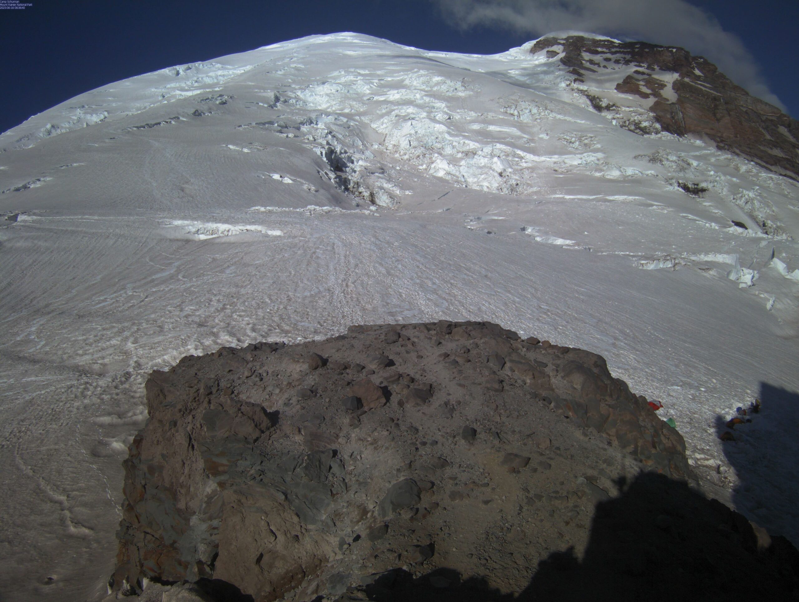
It’s a clear morning on Mount Rainier, but clouds and wind will be increasing rapidly today. It’s going to be an unsettled period ahead with a large trough of low pressure moving in. Here’s the view from Camp Schurman:

It’s a cloudy morning in Colorado. The atmosphere is primed for heavy afternoon precipitation. The view from 13,000ft looking West/Southwest from Arapahoe Basin:

Pikes Peak is loaded with snow. It’s been an abnormally snowy Spring with a few different intense precipitation events.
Below is a live cam from 6/16/2023 showing deep snow on the summit.

Why So Wet?
The Subtropical Jet Stream remains strong and influential. The door is wide open for moisture transport across the West helping to fuel afternoon rain/thunderstorms.
Below is the Global Forecast System’s jet stream forecast valid 6/17/2023. I marked the Subtropical Jet Stream below:

PNW Trough
An abnormally large trough drops into the PNW 6/17-6/21 riding the northern jet branch. This introduces rain/snow/wind for the high Cascades and Volcanoes.
Below is the Global Forecast System’s atmospheric pressure anomalies mid-atmosphere valid 6/18/2023. Pressure anomalies in the PNW are running 2-3 standard deviations below the 30-year norm.

Moisture Forecast
Two surges of atmospheric moisture are likely this weekend. Below you can see both ribbons of precipitable water anomalies valid 6/17/2023.

July 1
Late June and early July look more normal across parts of the West with a large dome of high pressure taking over. The precipitable water anomalies paint a clear picture. This doesn’t mean it’s totally dry, but rather a return to a more normal precipitation pattern.
This might also be a sign that the seasonal Monsoon is running behind schedule. It typically runs July-August.
Valid: July 1, 2023

Notice the large dome of high pressure valid June 27, 2023 lasting into early June.
Below the Global Forecast System believes higher atmospheric pressure anomalies are likely.

High Peaks
Mount Rainier, WA, Summit Level, Max Gusts (AM/PM), Precip
6/16: 30/55mph, PM Light Snow
6/17: 20/40mph, Dry
6/18: 55/25mph, PM Snow
6/19: 15/30mph, PM Snow
6/20: 25/25mph, Snow
Longs Peak, CO, Summit Level, Max Gusts (AM/PM)
6/16: 20/20mph, PM Heavy Snow
6/17: 20/30mph, PM Snow
6/18: 30/40mph, Dry
6/19: 30/30mph, Dry
6/20: 25/40mph, Dry
Mount Superior, UT, Summit Level, Max Gusts (AM/PM)
6/16: 25/25mph, PM Light Snow
6/17: 10/30mph, Dry
6/18: 35/50mph, PM Rain Shower
6/19: 35/55mph, PM Rain Shower
6/20: 50/25mph, AM Light Snow
Thanks again for the great weather update.
You bet, thanks, Kevin!