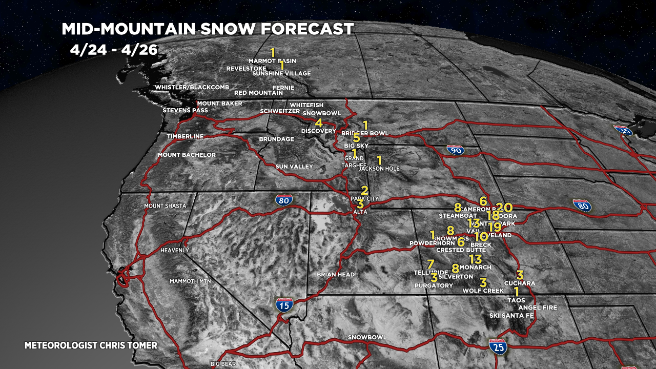
Tomer’s Take: Afternoon update with new data below. Heaviest snow in Colorado falls above 6,000ft and Divide-East with some exceptions.
My forecast video PM 4/24:
Mount Tukuhnikivatz
By request, my weekend forecast for Mount Tukuhnikivatz:
4/28: Dry, sunny, windy, gusts to 55mph, daily freezing level max/min: 11700’/10900′.
4/29: Dry, sunny, less wind, gusts to 20mph, 13500’/11800′.
4/30: Dry, sunny, less wind, gusts to 20mph, 14100’/13100′.
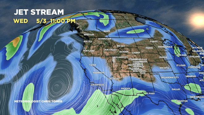
Forecast Pattern
Forecast jet stream valid 5/3. Main feature is a low off the CA coast. Otherwise the flow is light and disorganzied.
Forecast Totals
4/24-4/26:
The Colorado numbers are high-end and worst-case assuming the storm system comes together perfectly. Most places will end up with less.

4/27-5/3:
2nd storm system hits Colorado 4/26-4/27. It’s a fast mover.
