Tomer’s Take: Snow accumulation continues across PNW/BC/MT/ID/WY/UT/CO. Two additional storm systems will push season totals further into all-time record territory.
Projected Melt-Out
50th Percentile Projection:
Schofield Pass, CO: June 20 (Dust layer could accelerate)
Red Mountain Pass, CO: June 12 (Dust layer could accelerate)
Forecast Freezing Level
Wasatch, Maximum/Minimum:
4/20: 6100’/5100′
4/21: 7700’/6600′
4/22: 7700’/6600′
4/23: 10500’/8900′
4/24: 9800’/9500′
4/25: 7700’/6400′
Colorado’s Central Mountain Zone, Maximum /Minimum:
4/20: 6100’/3800′
4/21: 8000’/5300′
4/22: 9400’/7100′
4/23: 11000’/8700′
4/24: 10700’/9200′
4/25: 10000’/8200′
Forecast Pattern
Forecast jet stream valid 4/29. Small high pressure ridging over Intermountain West with an area of low pressure off the West Coast.

Forecast Timing
Forecast radar/satellite valid 4/20-4/25.
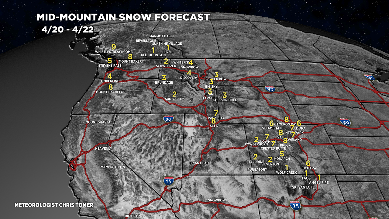
Forecast Totals
4/20-4/22:

4/23-4/29:
