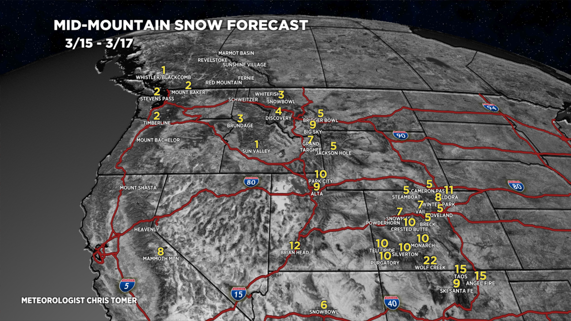
Tomer’s Take: Two storm systems are likely across the West through 3/24. The snow bullseyes are CA, AZ, UT, NM, and CO. Snow levels start high on 3/15 then gradually fall. The PNW and Northern Tier are largely out of the storm track with lighter accumulation.
Forecast Wasatch Rain/Snow Line
3/15: 7600′ early, 6500′ afternoon
Forecast Pattern
Forecast jet stream valid 3/21. Notice the trough and gathering storm system over CA.

Forecast Timing
Forecast radar/satellite valid 3/15-3/20.
Forecast Totals
3/15-3/17:

3/18-3/24:

3/16-3/24:

Castle Rock receiving anything?
Hi Bonnie, you probably have snow falling as I type this. Chris