Tomer’s Take: There are two storm systems that run across the West through 2/13. 1st: 2/5-2/6. 2nd: 2/8-2/9. A third approaches CA on 2/13.
Mount Baker is reporting 9 inches in the last 24 hours. I’m forecasting another 40 inches by 2/8.
My video forecast 2/4:
Current Setup
Water vapor satellite shows two storm systems lined-up in the Pacific. Initial trajectory is the PNW/BC then the Intermountain West.

Forecast Pattern
Forecast jet stream valid 2/13. A storm system approaches CA while fighting high pressure ridging over the Intermountain West.

Forecast Timing
Forecast radar/satellite valid 2/4-2/9.
Forecast Totals
Forecast snow totals (inches) valid 2/4-2/6.
Wasatch snow timing: 2/5-2/6 and 2/8.
Colorado snow timing: 2/5-2/6, 2/8-2/9.

Forecast snow totals (inches) valid 2/7-2/13.

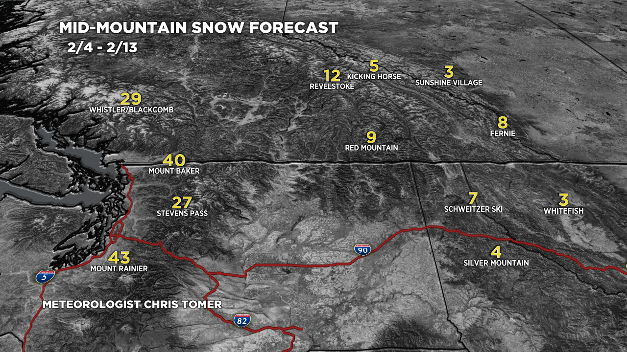
Forecast snow totals (inches) valid 2/4-2/13.

Forecast snow totals (inches) valid 2/4-2/13.
Mount Baker, Whistler/Blackcomb, Stevens Pass, and Rainier should hit these totals by 2/8.

Forecast snow totals (inches) valid 2/4-2/13.
