Tomer’s Take: Two moderate to strong intensity atmospheric river (AR) surges are possible through 3/16 generating deep snow bullseyes.
Current Setup
Infrared satellite shows an active northern jet branch loaded with areas of low pressure.

Forecast Pattern
Forecast jet stream valid 3/11. The Pineapple Express in full swing. The flow nails the Sierra like a firehose.

Atmospheric River Foreast
Below is the ECMWF Integrated Vapor Transport (IVT) forecast for the Central CA Coast. Notice two surges: Late 3/9 through 3/12, and late 3/13 though 3/14.

Forecast Timing
Forecast radar/satellite valid 3/7-3/11.
Kirkwood, CA
3/7: 3″
3/8: 5″
3/9: 12″+
3/10: 25-30″+
3/11: 12″
3/12: 5″
3/14: 15-20″
3/15: 2″
Brighton, UT
3/7: 2″
3/8: 3″
3/10: 6-8″
3/11: 4″
3/12: 4″
3/14: 4″
3/15: 20″+
3/16: 6″
Forecast Totals
3/7-3/9:

3/10-3/16:

3/7-3/16:
Central and Northern CO Mountains Grand Totals.

3/7-3/16:
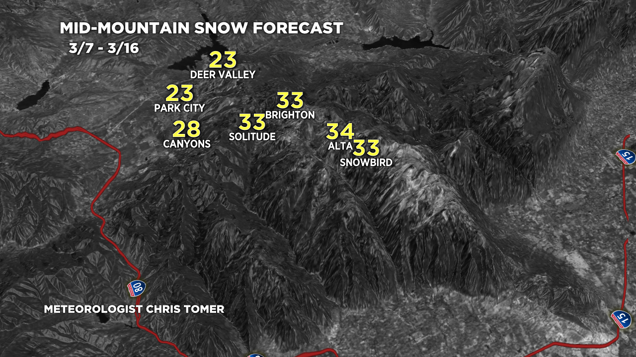
Wasatch Grand Totals.

3/7-3/16:
Sierra Grand Totals.

3/7-3/16:
VT/NH/ME Key Snow Dates:
3/7: 1″
3/8: 1″
3/9: 1″
3/14: 12″
3/15: 10″
3/16: 2″
