Tomer’s Take: The jet stays active for the West through 3/13 with three different storm systems.
My mountain weather forecast video 3/13:
Current Setup
Water vapor satellite shows a large trough of low pressure hitting the West Coast with 2-3 feet of snow for the Sierra and heavy accumulation for the Wasatch Front.

Forecast Pattern
Forecast jet stream valid 3/13. Pattern appears benign for the Intermountain West (in-between) with next trough sitting over the Pacific.

Forecast Timing
Forecast radar/satellite valid 3/4-3/9.
Solitude, UT
3/4: Late 4-5″
3/5: 6″
3/6: 10″
3/7: 5″
3/8: 1″
3/9: 1″
3/11: 4″
Kirkwood, CA
3/4: PM 8″
3/5: 15″
3/6: 6″
3/7: 2″
3/8: 4″
3/10: 13″
3/11: 6″
3/13: 1″
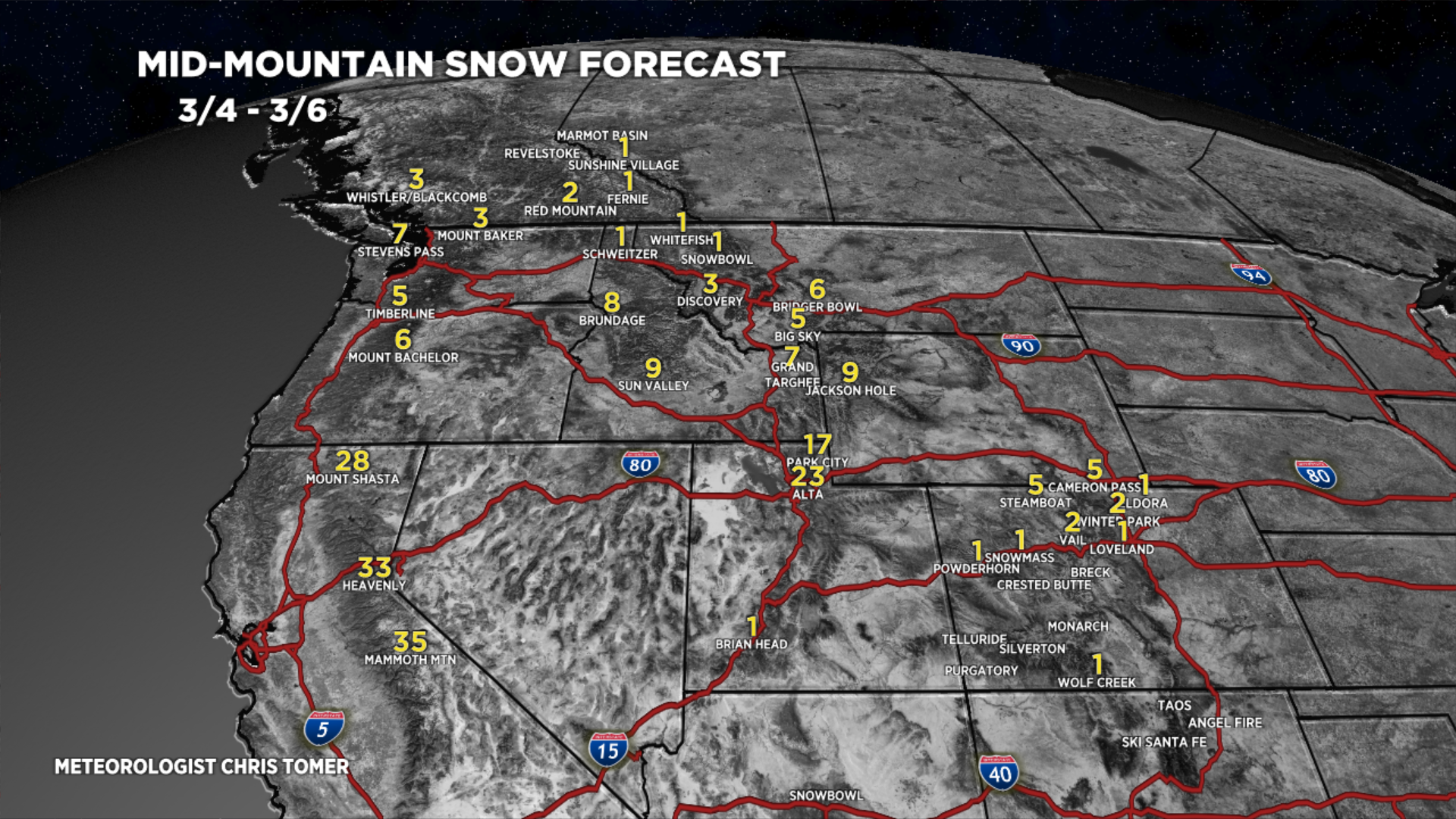
Forecast Totals
3/4-3/6:

3/7-3/13:

3/4-3/13:

3/4-3/13:

3/4-3/13.
VT/NH/ME Key Snow Dates:
3/4: 10-14″
3/5: 1″
3/7: 1″
3/9: 1″

Skunk train continues for CO! Wow. Especially for Loveland and Abasin on the Divide. Seems we’re getting more in Frisco than mountains.
Chris….do you see any patterns favoring us down road? Big NW flow pattern that is?
Thanks, CW. Love the term “skunk train”! Might use it from now on ;-P