Tomer’s Take: Three different storm systems are lined-up through 12/12 with big totals for most of the West.
- Storm #1 rides a powerful SW to NE oriented jet stream. It targets specific locations in CO with heavy orographic snowfall. Big powder likely at Vail Pass, Wolf Creek, Purgatory, Crested Butte, Steamboat 12/5-12/8.
- Unfortunately, for the second day in a row, I shaved my forecast totals for the Wasatch and Tetons 12/4-12/6.
- Storm #2 + storm #3 look more significant for the Wasatch between 12/9-12/12.
My forecast video including snow plume for Vail Mountain/Vail Pass:
Forecast Timing
Forecast radar and satellite valid 12/4-12/9.
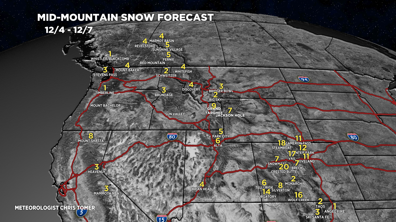
Forecast Totals
Forecast snow totals (inches) valid 12/4-12/7.

Forecast snow totals (inches) valid 12/8-12/12.

It’s beginning to look a lot like Christmas!🎄🎄🎄