Tomer’s Take: The pattern is about to turn a lot more active for the West with three different storm systems lined-up through 12/3.
- Storm #1 is minor and fast-moving 11/26-11/27 with only light snow accumulation for PNW, ID, MT, WY, UT, CO.
- Storm #2 is major with colder air 11/27-11/29 for the same region.
- Storm #3 is major and goes further south 11/30-12/3 benefitting PNW, CA, MT, ID, WY, UT, CO, NM.
Current Setup
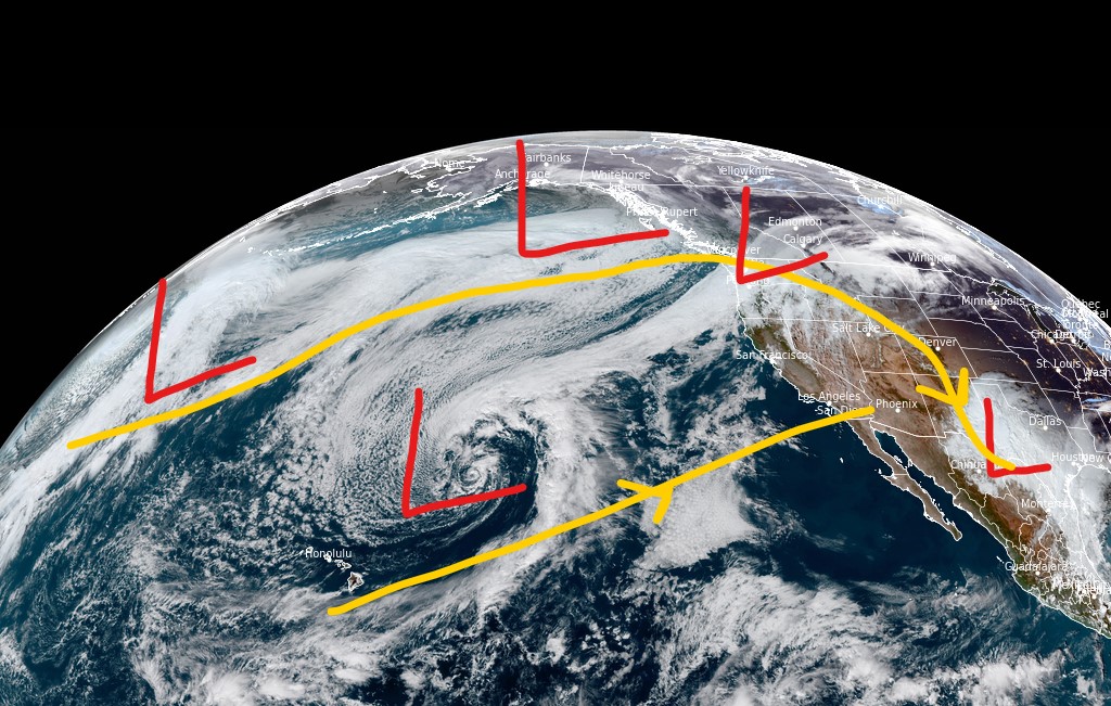
Visible satellite shows a crowded storm track with several low pressure systems lined-up in the Pacific. The southern branch of the jet stream is also active.

Western Jet Stream
Storm #1 is minor, fast-moving with light snow accumulation 11/26-11/27.
Storm #2 (below) is major with better jet support and a load of cold air from Canada.
The storm track is energized.

Storm #3 (below) is riding a fast west-to-east jet stream and plenty of moisture potential.

Forecast Snowfall
Storm #1 accumulation with some PNW influence from storm #2.
Forecast snow totals (inches) valid 11/25-11/27.

Storm #2 accumulation with some CA/PNW influence from storm #3.
Forecast snow totals (inches) valid 11/28-12/1.

Storm #3.
Forecast snow totals (inches) valid 12/2-12/3.

alright ! thank you!