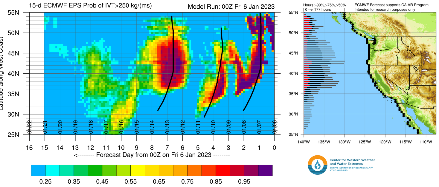
Tomer’s Take: I’m forecasting three more atmospheric river (AR) surges through 1/15. Beyond 1/15 the atmospheric river is much weaker and fading.
Snow levels will run high 1/7-1/10. Best Sierra snow stays above 7,000ft.
Alta, UT is reporting 11″ in the last 24 hours. The pushes them up to 319″ for the season.

Current Setup
Infrared satellite shows a busy Pacific storm track with atmospheric river contribution. The powerhouse low pressure from 1/4-1/5 still spinning off the coast. The other low pressure’s will rotate around it like spokes on a wheel.

Forecast Pattern
Forecast jet stream valid 1/6-1/11. The jet pattern much less supportive of AR activity. It’s more amplified with definite troughs and ridging.

Atmospheric River
Below is the ECMWF IVT 16-day forecast by latitude. I marked the next three surges.

Forecast Timing
Forecast radar/satellite valid 1/6-1/11.
Forecast Totals
Forecast snow totals (inches) valid 1/6-1/8.

Forecast snow totals (inches) valid 1/9-1/15.

Forecast snow totals (inches) valid 1/6-1/15.

I appreciate the work you do. Thank you.
Thanks, Rhino!