Tomer’s Take: I’m tracking three moderate intensity atmospheric river (AR) surges through 1/12. Biggest totals occur in CA, WA, OR, BC.
Current Setup
Infrared satellite shows the Pineapple Express and low pressure systems lined-up.

Forecast Pattern
Forecast jet stream valid 1/12 shows a choppy jet stream with well-defined dips and ridges. This pattern favors the West Coast for biggest snow totals with less through the interior Rockies.

Atmospheric River
The latest GEFS IVT forecast by latitude shows three additional moderate intensity AR surges through 1/12. Beyond, there are weaker AR surges through 1/19. The surges occur 1/4-1/5, 1/8, 1/10.
I continue to worry about catastrophic flooding at the lower elevations of Northern California through 1/12 with potentially 15-20 inches of additional rainfall.

Forecast Timing
Forecast radar/satellite valid 1/3-1/8.
Forecast totals
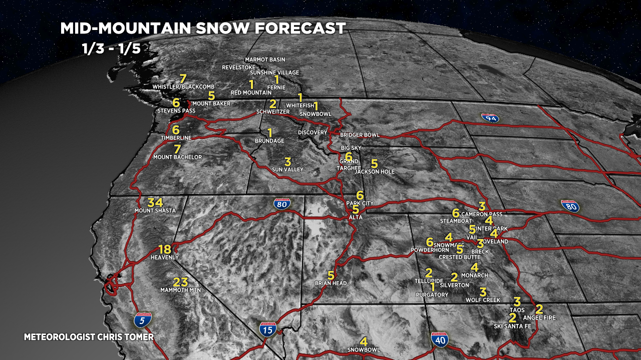
Forecast snow totals (inches) valid 1/3-1/5.

Forecast snow totals (inches) valid 1/6-1/12.

Forecast snow totals (inches) valid 1/3-1/12. The bulk of this snow occurs 1/4-1/5 and with a possible coastal storm system on/about 1/12.

Hey Chis,
As most of the snow has fallen to west of Continental divide, is the risk of avalanche med/lo on some of the I70 trails east of CD like Herman Gulch, trail to Gray’s/Kelso trailhead etc ? i,e is it not a bad idea for snoweshoeing/AT skis outoing ?
Hi Ravi, really depends on terrain selection. Go with low angle and stay off steep terrain. If you haven’t already, consider taking an avalanche safety class. Chris