Tomer’s Take: 1-2 additional atmospheric river surges are likely through 1/17 then it fades. A high pressure ridge is possible across the West on/after 1/22, but some places might actually be favored for snowfall.
Snowbird, UT is reporting 36 inches in 48 hours.
Mammoth Mountain, CA is reporting 72 inches in 72 hours.
My afternoon update forecast video:
Season To Date

Current Setup
Infrared satellite shows the Pineapple Express and two additional areas of low pressure over the Pacific. They represent the final pieces of this incredible 15 day atmospheric river.

Forecast Pattern
Forecast jet stream valid 1/20. A West Coast ridge is starting to develop. But, that could deliver snow to MT, WY, UT, CO.

Late January
Below is a look at EPS atmospheric pressure anomalies in the middle of the atmosphere. Notice the West Coast Ridge.

Forecast Timing
Forecast radar/satellite valid 1/11-1/16.
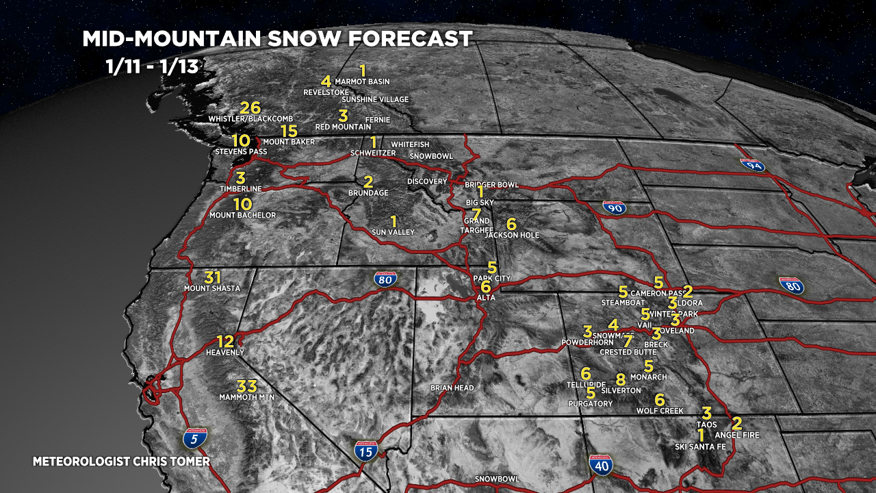
Forecast Totals
Forecast snow totals (inches) valid 1/11-1/13.

Forecast snow totals (inches) valid 1/14-1/20.

Forecast snow totals (inches) valid 1/12-1/20. Snow to rain is likely 1/13-1/14. A colder, more potent storm systems is possible 1/19-1/20. That’s when 90% of this accumulation occurs.

Can you add Whiteface to the forecast for the East?
Hi Stephen, I’ll put Whiteface on my list. Chris