Tomer’s Take: A much more active pattern for the West looms after 11/27 with widespread snow and colder temps.
- There are two storm systems for the West between 11/27 and 12/3.
- The combination generates heavy widespread accumulation.
- In the Northeast, three different storm systems are lined-up through 12/2. The first is minor on 11/25. The 2nd is mainly rain (then changes to snow) on 11/27-11/28, and the third is similar on 11/30-12/1.
Current Setup
Visible satellite shows the storm track and two low pressure systems lined-up over the Pacific. Both will impact the West, but the first low is minor and fast-moving. The 2nd low becomes a widespread snow producer 11/27-11/29.

Northeast Pattern
The track of storm #2 and #3 follow this jet pattern. They are too far north leaving most ski areas warm enough for rain initially (then snow on the backside).

Forecast snow totals (inches) valid 11/24-12/2.

Western Pattern
Storm #1: A big dip in the stream delivers colder air and widespread snow accumulation across the West.
Forecast jet stream valid 11/28.

Storm #2: Similar track to storm #1 (a little further south) with colder air and widespread snow accumulation.
Forecast jet stream valid 12/2.

Forecast Snowfall
Forecast snow totals (inches) valid 11/24-11/26.

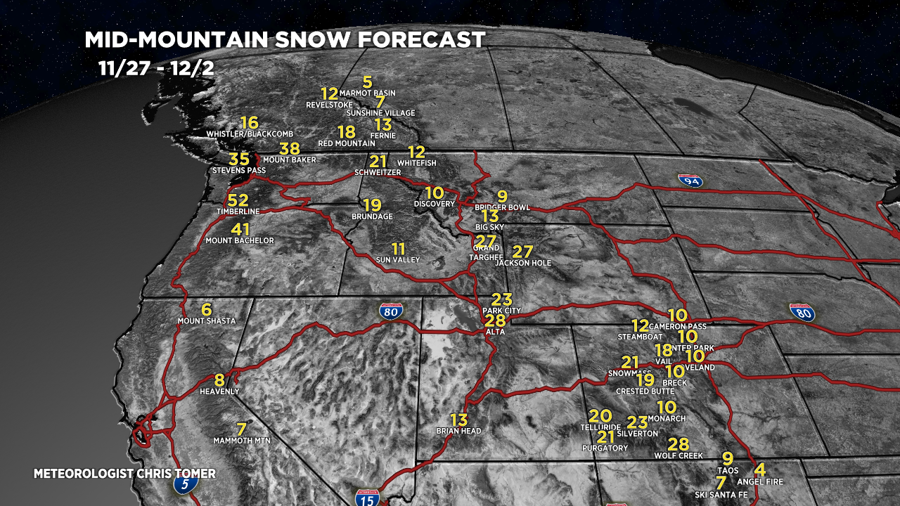
Forecast snow totals (inches) valid 11/27-12/2.
This forecast chart captures total accumulation from both Storm #1 and Storm #2.

woohoo