Tomer’s Take:
- Current fast N-S jet flow through MT, WY, CO gradually ends.
- Much drier pattern for West continues.
- Pattern shift for PNW/BC, MT, ID, WY on/after 11/21 but it’s not optimal.
- Jet axis bends even further north keeping most of the Rockies drier than normal.
- Eastern/Northeast: A larger Thanksgiving weekend storm system possible 11/25-11/27.
Current Setup
Infrared satellite shows the storm track, fast N-S jet flow with cold front, and robust PNW high pressure ridge.

Thanksgiving Pattern
Forecast jet stream flow on Thanksgiving 11/24 shows the shifting pattern with the jet axis bending far to the north. Some moisture feeds into the PNW/BC/Banff. The trend is for this bend to bend even further north keeping CA, UT, CO, NM drier.

Forecast jet stream flow on 11/26. The axis stays put with CA, UT, CO, NM staying dry.

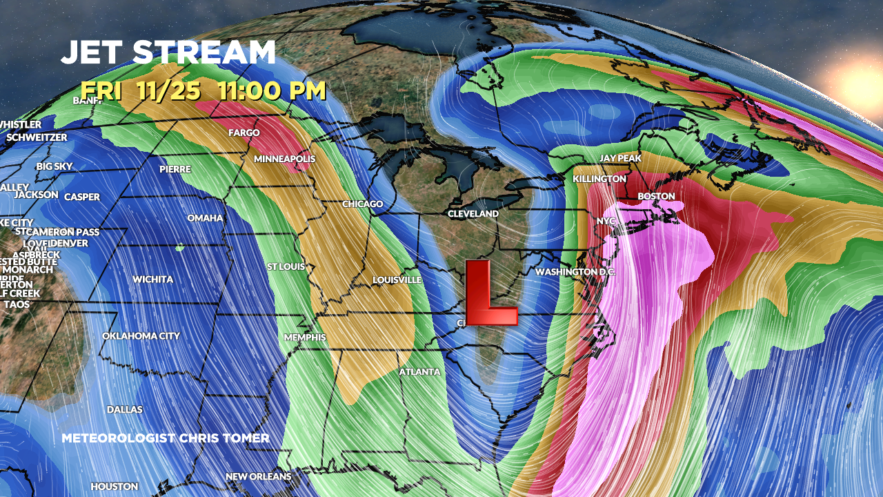
Northeast Storm System?
Forecast jet stream flow valid 11/25 suggests a large dip supporting a developing area of low pressure. This is something to watch.

Forecast Timing
Forecast radar/satellite valid 11/18-11/23.
Forecast Snowfall
Forecast total snowfall (inches) valid 11/18-11/20.
Talk about an incredibly dry period with robust ridging over the PNW/BC.

Forecast total snowfall (inches) valid 11/21-11/26.
Even after a pattern shift on/after 11/21 the jet axis bends far to the north leaving most of the Rockies dry.

My forecast video 11/18:
I think your plan of underforecasting snow fall in Colorado is working.
6 inches of snow out of nowhere today at A basin.
Wahoo
Were skiing A-Basin, Ben?! Going to be a dry stretch now. Chris