Tomer’s Take:
- Final storm system of this storm cycle now moving through California. Next stop is the Intermountain West.
- Powerful jet streak, orographics, and very weak atmospheric river (AR) contribution.
- Storm cycle ends 11/10. What happens after? High pressure rebuilds until 11/13 then a dry trough rotates through the West.
Current Setup
Infrared satellite shows the sprawling low pressure, trough, and powerful jet flow around the low.

November 9
By 11/9 the main trough, jet, and low pressure are moving East into CO and beyond. Heavy snow is likely in UT, WY. Moderate snow in CO and SW MT.

Forecast Timing
Forecast radar/satellite valid 11/8-11/13.
Below Zero CO High Peaks
Much colder air and strong wind are likely as this storm system slides north/through Colorado.
| Longs Peak | MPH | F |
| 11/9 | 45 | 25 |
| 11/10 | 65 | -3 |
| Quandary Peak | MPH | F |
| 11/9 | 60 | 21 |
| 11/10 | 35 | -13 |
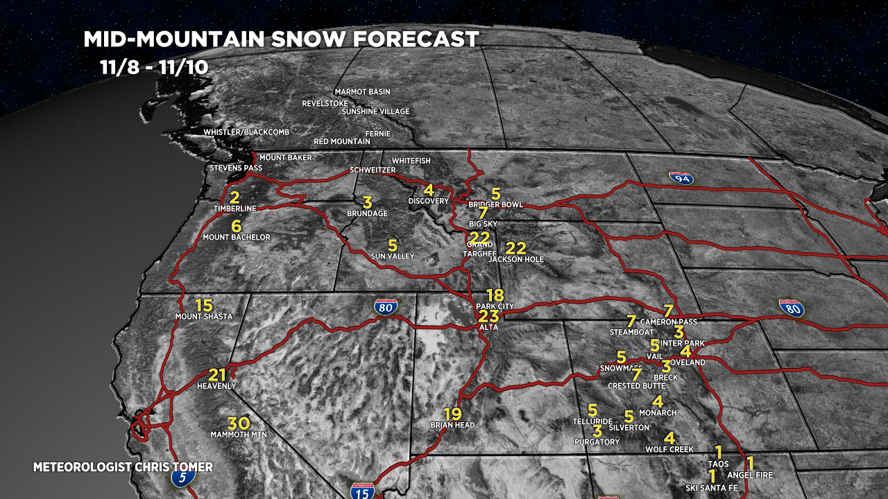
Forecast Snowfall
Forecast snow totals (inches) between 11/8-11/10.
*My forecast totals for the Tetons are optimistic and high-end. It’s more likely they’re lower (around 15-18″) but let’s see what happens.

Forecast snow totals (inches) between 11/11-11/14.
Talk about a dry period post-storm cycle.

My forecast video 11/8: