Tomer’s Take:
- As storm #1 departs CO/NM, storm #2 and storm #3 are lined-up.
- Each could deliver brief atmospheric river (AR) contributions.
- Each could deliver proper orographics with big snow totals including the Sierra and interior Rockies.
Current Setup
Water vapor satellite shows the storm track and atmospheric river setup pointed directly at the PNW/BC. This flow could shift south and nail (briefly) the Sierra and also generate heavy snow through the interior Rockies. Red/orange = drier air aloft.

AR Setup
Forecast jet stream flow shows the potential for heavy precipitation with proper orographics.
Valid 11/7/2022:

Forecast jet stream flow valid 11/8/2022.

Forecast Integrated Water Vapor Transport (IVT) for the Bay Area, CA. Weak to moderate AR potential.

Forecast Timing
Forecast radar and satellite valid 11/4-11/9.
Forecast Snowfall
Forecast snow totals (inches) valid 11/4-11/5.

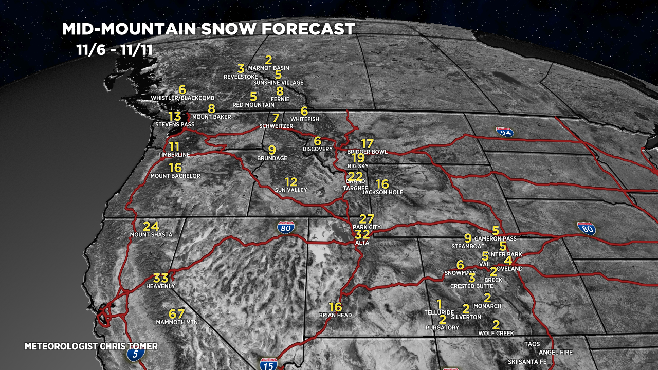
Forecast snow totals (inches) valid 11/6-11/11.

My forecast video 11/4:

I sure hope these weather reports continue in your new role! Thx, Chris!
Doug! I’ll never stop my mountain weather forecasts, blog, and YouTube channel. Absolutely love doing it. Chris
awesome!
Good morning Chris,
Congratulations on your new role at Good Day.
Bring on the snow. The more, the merrier! We can use all that we can get!
Have a great weekend, my friend.
Thanks, Brian! Appreciate your support all these years. Chris
So nice to get your take on this snow storm and the others coming through next week. What a relief to continue seeing your input.
Thanks, Brenda! I love this stuff. I’ll continue doing my mountain weather forecasts, blog, and YouTube channel. Chris