Tomer’s Take: An Arctic front is diving south through MT, WY, and CO driving the snow accumulation. This Arctic front then moves east and develops into a deep area of low pressure for the Great Lakes and Northeast. Unfortunately, the track puts the ski areas of VT, NH, and ME in the warm sector with a mix of precipitation. On/after 12/27 the West could see a moderate intensity atmospheric river.
My forecast video 12/21:
Forecast Timing
Forecast radar/satellite valid 12/21-12/26.
Forecast Snow Totals
Forecast totals (inches) valid 12/21-12/23.

Forecast totals (inches) valid 12/24-12/26.

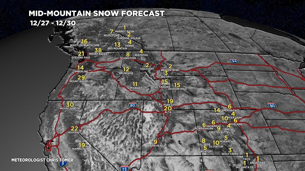
Forecast totals (inches) valid 12/27-12/30.

Forecast totals (inches) valid 12/22-12/26.

Hey, Chris! Will this bitter cold kill off the pine beetle? When we lived in Vail, we were told that only fire or bitter cold could kill them.
Hi Anne, I don’t think we can get cold enough for long enough to kill them. Chris
wow that would be so great if the beetles did not survive.
i could do without the grasshoppers too.