Tomer’s Take: Snow continues in the Northeast into 1/26 then a series of Clippers arrive. A fast Northwest Flow dominates the West until 1/28 when the pattern pivots south delivering big totals.
My forecast video 1/25:
Current Setup
Water vapor satellite shows the Northwest Flow across the West and big trough with storm system sliding through the Northeast.
Orange/red = drier air aloft.

Forecast Pattern
Forecast jet stream 2/3.
Active period 1/25-2/1.
Quiet period: 2/2-2/4.

Forecast Timing
Forecast radar/satellite valid 1/25-1/30.
Forecast Totals
Forecast snow totals (inches) valid 1/25-1/27.

Forecast snow totals (inches) valid 1/28-2/3.

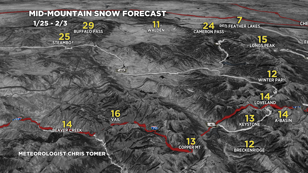
Forecast C+N CO snow totals (inches) valid 1/25-2/3.

Forecast Steamboat, CO Snow Plume:

Forecast snow totals (inches) valid 1/25-2/3. The bulk of this snow occurs 1/25-1/26 and potentially 2/1-2/2.

Chris,
I love your work. I am not seeing anything resembling your SW CO totals 1/28-2/3 on any of the deterministic or ensemble models. What am I missing?
Thanks, Jeff. I’m still not 100% on totals. Watching the track/intensity of the southern low. Wolf Creek should top the list 1-2 feet. Chris