Tomer’s Take:
- Fast N-S jet flow 11/17-11/18 delivers light snow accumulation to WY and CO and much colder air temps.
- In Colorado, moderate snow accumulation likely in the Foothills of Boulder and Larimer Counties with 5-10 inches of total accumulation.
- PNW/BC stay dry through 11/20 then pattern shifts on/after 11/21.
- Best snow on/after 11/21 favors PNW/BC/Banff and northern tier of the Rockies.
- Pattern does not immediately favor UT, CO, NM, CA but might in the longer term.
- Watching Thanksgiving weekend for possible East/Northeast coastal low.
Current Setup
Infrared satellite shows the storm track, robust Eastern Pacific high pressure ridge, and strong cold front racing through MT, WY, CO on a fast N-S jet.

Thanksgiving Pattern Shift
Forecast jet flow valid 11/18 shows the robust PNW high pressure ridge and fast N-S jet flow through MT, WY, CO.

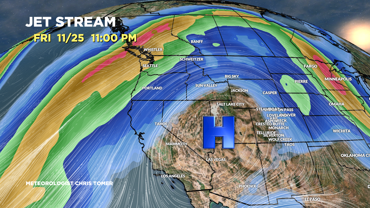
Forecast jet flow valid 11/25 shows a complete pattern shift. A powerful jet stream has replaced the PNW high pressure ridge. The axis is so far north that the best snow favors PNW/BC and northern tier of the rockies.

Forecast Timing
Forecast radar/satellite valid 11/17-11/22.
Forecast Snowfall
Forecast snowfall totals (inches) valid 11/17-11/19.
In Colorado, moderate snow accumulation likely in the Foothills of Boulder and Larimer Counties with 5-10 inches of total accumulation. Eldora, Longs Peak, Cameron Pass, and the Indian Peaks all included.
Overnight lows into Friday morning reach -10 to -20F on the CO 13ers/14ers.

Forecast snowfall totals (inches) valid 11/20-11/25.

I think I should go skiing- CP
I think I will, Judi! Chris