Tomer’s Take: A fast northwest flow (NWF) stays in place through 1/28 favoring the Northern tier of the Rockies then the jet shifts south and lower pressures expand across the West into 2/1.
My forecast video 1/23:
Current Setup
Water vapor satellite shows a high pressure ridge off the West Coast and NWF favoring the Northern tier of the Rockies. On/after 1/28 the high pressure retrogrades opening the door for a trough across the West.

Forecast Pattern
Forecast jet stream valid 2/1. Active jet pattern for the West with areas of low pressure traversing the West.

Forecast Timing
Forecast radar/satellite valid 1/23-1/28.
Forecast Totals
Forecast snow totals (inches) valid 1/23-1/25.

Forecast snow totals (inches) valid 1/26-2/1.

Forecast Snow Plume for Jackson Hole.
Bulk of accumulation occurs late 1/26-1/29.

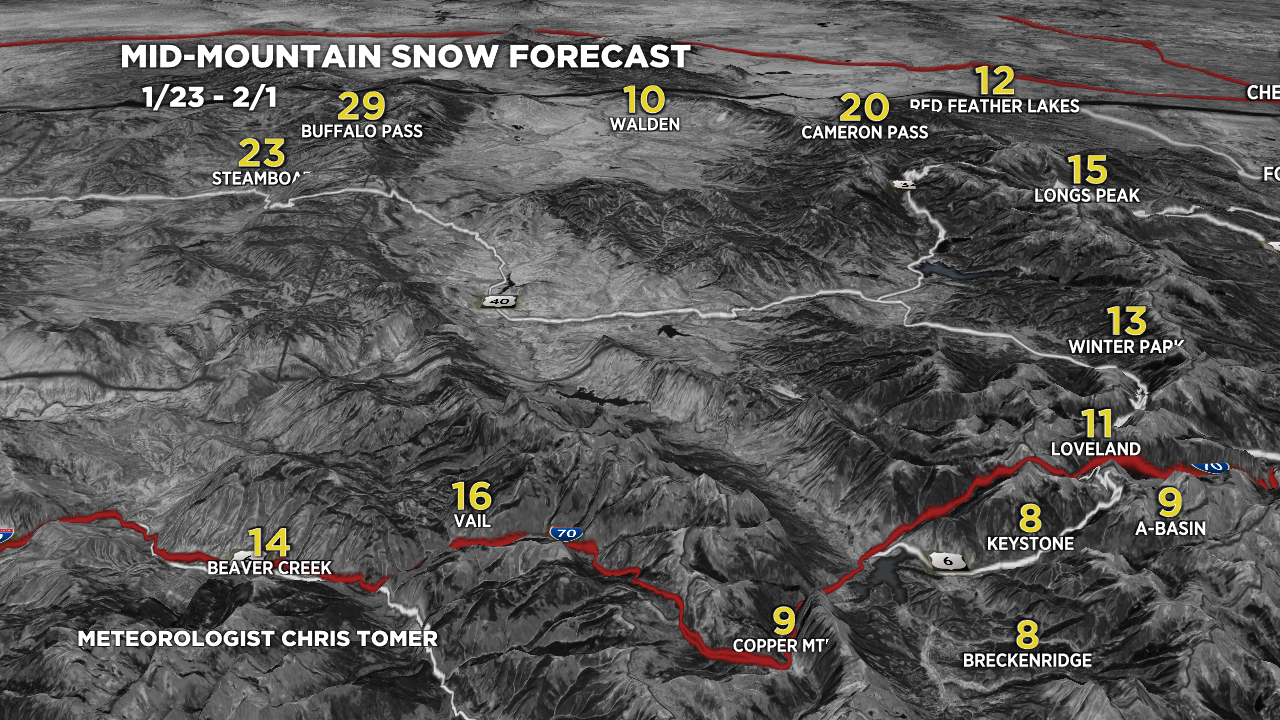
Forecast C+N CO snow totals (inches) valid 1/23-2/1.
Steamboat snow timeline:
Prolonged period of light/moderate snow accumulation late 1/24-1/31.
Biggest days appear to be 1/27-1/30.

Forecast Northeast snow totals (inches) valid 1/23-2/1.
Snow continues 1/23 then fades.
Next storm system: 1/25-1/26.
Possible storm system: 1/30.
