Tomer’s Take: Heavy snow is falling across VT, NH, ME through 12/17. Then the pattern gradually shifts to favor the PNW/BC and northern tier of states. By Christmas a NW flow might develop to include CO.
My forecast video 12/16:
Current Western Snowpack
It resembles a La Nina pattern but with a slight shift south/west. California has benefited from 2-3 AR events with some subtropical jet involvement.
In CO, it’s mostly La Nina with a shift west/NW.

Current Setup
Water vapor satellite shows a fast, moisture-starved jet stream cutting through the Intermountain West. Most of the action is in the NE with a trough.
Orange/red = drier air aloft.

Forecast Pattern through Christmas
Forecast jet stream valid 12/17/2022. Benign pattern for most of the West.

Forecast jet stream valid 12/25/2022. This pattern supports a NW flow for MT, WY, CO.

Forecast Timing
Forecast radar/satellite valid 12/16-12/21.
Forecast Totals
Forecast snow totals (inches) valid 12/16-12/18. Most of the West is quiet except for PNW/BC/Banff.

Forecast snow totals (inches) valid 12/19-12/22. Strong jet flow generates moderate to heavy snow PNW/BC, ID, MT, WY.

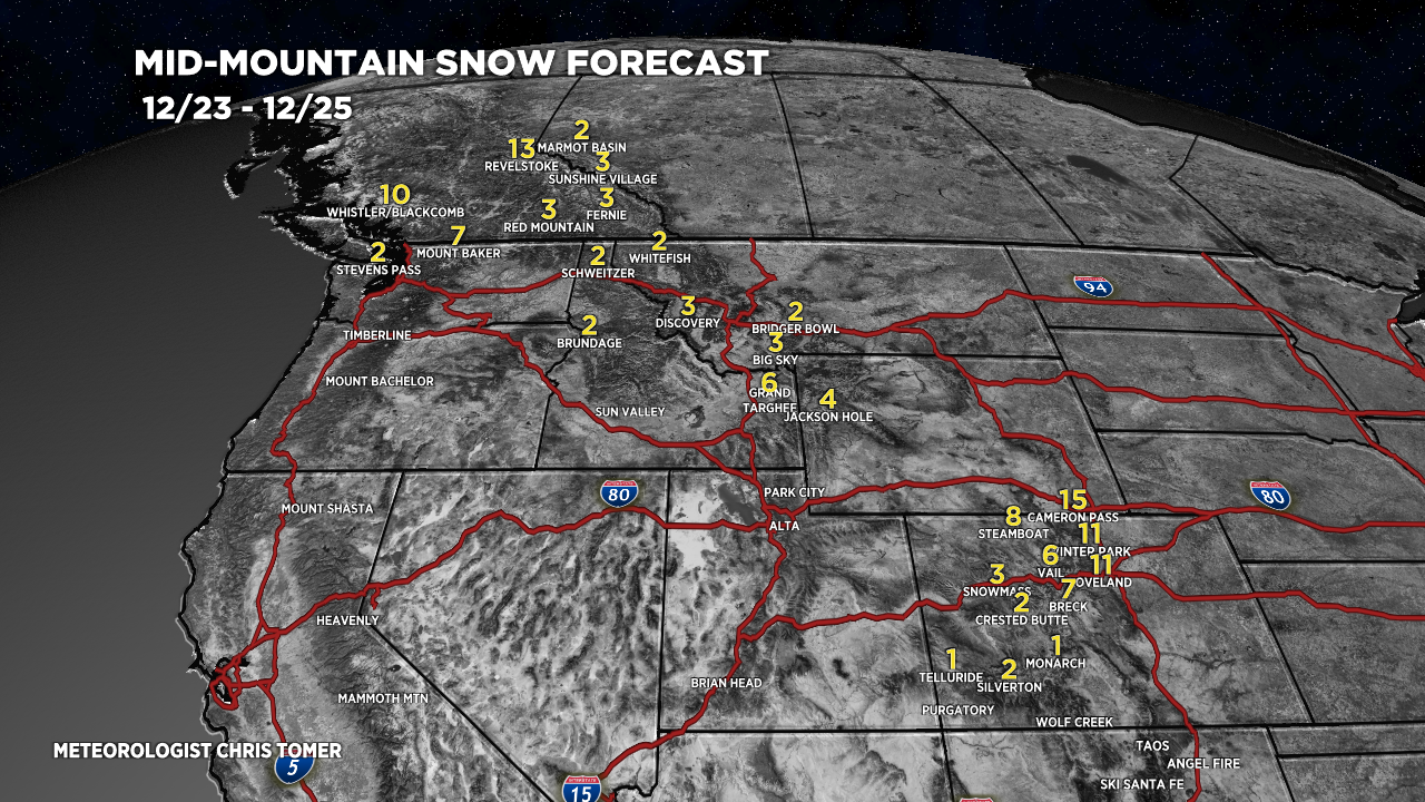
Forecast snow totals (inches) valid 12/23-12/25. A NW flow might develop for MT, WY, CO.

Forecast snow totals (inches) valid 12/16-12/18.

Forecast snow totals (inches) valid 12/19-12/25. The bulk of this snow occurs with a potential storm system on/around 12/23.
