Tomer’s Take: The storm track remains active through 4/1. Snow bullseyes in CA, WY, MT, CO, UT.
13 inches new at Alta in the last 24 hours puts them at 720 inches for the season.
9 inches new at Grand Targhee in the last 24 hours puts them at 453 inches for the season.
8 inches new at Jackson Hole in the last 24 hours puts them at 533 inches for the season.
8 inches new at Wolf Creek in the last 24 hours puts them at 462 inches for the season.
Forecast Pattern
Forecast jet stream valid 4/1. The northern branch favors the PNW/Northern Tier. Southern branch has a meandering low.

Forecast Timing
Forecast radar/satellite valid 3/23-3/28.
Brighton, UT
3/23: 2-3″
3/24: 8-10″
3/25: 1″
3/26: 2″
3/29: 8-12′
3/30: 3-6″
3/31: 2″
Forecast Totals
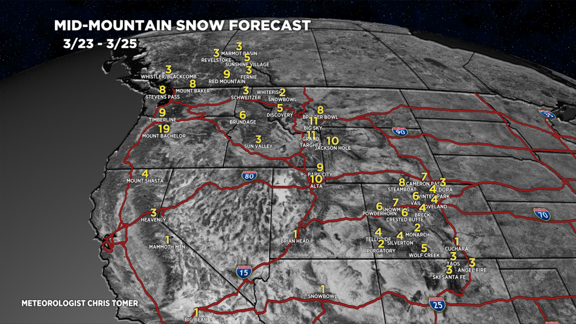
3/23-3/25:

3/26-4/1:

3/23-4/1:
VT/NH/ME Key Snow Dates: 3/25-3/26.

Why is Loveland at the bottom of the pack this year for snowfall compared to other areas? Do we need to sacrifice another goat?