Tomer’s Take: 3-4 storm systems are lined-up through 3/5 for the West. A powerful northern jet and southern jet remain contributing factors. Deep snow accumulation bullseyes remain likely.
29″ in 48 hours at Purgatory, CO.
31″ in 48 hours at Wolf Creek, CO.
14″ in 48 hours at Kirkwood, CA.
Current Setup
Water vapor shows the almost cut-off area of low pressure moving at snails pace south through the Sierra. It will sit and spin in CA for a couple more days delivering heavy snow before it ejects into the Intermountain West. Additional storm systems are lined-up in a busy Pacific.

Forecast Pattern
Forecast jet stream valid 3/1. An area of low pressure is sliding through the Intermountain West.

Forecast Pattern March 10
Forecast atmospheric pressure anomalies (mid-atmosphere) valid March 10. The West remains active with a signal for lower atmospheric pressures.

Telluride, CO
2/24: 2″
2/26: 6″
2/28: 5″
3/1: 5″
3/5: 5″
Brighton, UT
2/24: 1″
2/26: 5″
2/27: 8″
2/28: 12″
3/1: 2″
3/4: 2″
3/5: 2″
Kirkwood, CA
2/24: 14″
2/25: 6″
2/26: 6″
2/27: 14″
2/28: 14″
3/1: 14″
3/4: 6″
3/5: 6″
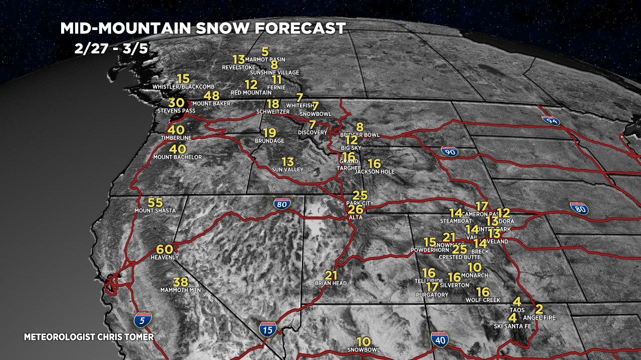
Forecast Totals
2/24-2/26:

2/27-3/5:

2/24-3/5:

2/24-3/5:

2/24-3/5:
