Tomer’s Take: It’s a powder day in the Northeast! I’m forecasting 2-3 additional Clippers through 2/4. Out West, a fast Northwest Flow (NWF) continues then the whole pattern pivots on/about 1/28. This spreads snow and colder temps south through the middle and southern Rockies. Then a quiet period builds 2/1-2/4.
My forecast video 1/26:
Current Setup
Water vapor satellite shows the fast Northwest Flow across the northern Rockies. On/after 1/28 the high pressure retrogrades and the NWF pivots south with lower atmospheric pressures.

Forecast Pattern
Forecast jet stream valid 2/4. This is a quiet period for the West with the bulk of moisture routed through BC/PNW/Canada around a high pressure ridge.

Forecast Timing
Forecast radar/satellite valid 1/26-1/31.
Forecast Timing
Forecast snow totals (inches) valid 1/26-1/28.

Forecast snow totals (inches) valid 1/29-2/4.

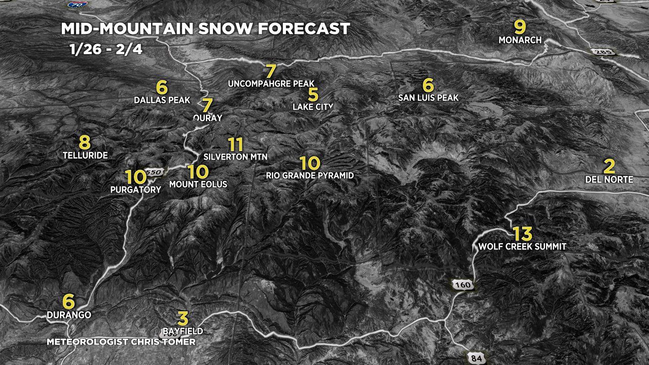
Forecast Southern CO snow totals (inches) valid 1/26-2/4.

Forecast C+N CO snow totals (inches) valid 1/26-2/4.

Forecast Snow Plume for Jackson Hole, WY.

Forecast snow totals (inches) valid 1/26-2/4.
Clippers:
1/29, 1/30, 1/31, maybe 2/3.
