Tomer’s Take: A ‘strong to extreme intensity’ atmospheric river arrives on/after 12/27 through 1/3 across the West with big snow totals. Out East, it’s cold and windy in the wake of the Blizzard with lake effect snow.
I snapped this aerial photo of the Eastern Plains of Colorado on Friday 12/23. It looks like the moon with wind-blasted snow and inverted temps around zero.

My forecast video 12/24:
Current Setup
Infrared satellite shows the organizing atmospheric river (AR) in the Pacific. The moisture fetch extends to Hawaii.

Forecast Pattern
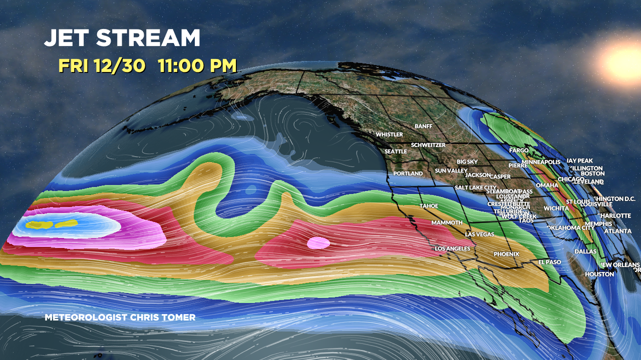
Forecast jet stream valid 12/30/2022. Powerful west-to-east jet stream delivers heavy precipitation. The rain/snow line has to be watched.

Let’s zoom out. Forecast jet stream valid 12/30/2022. This paints a very clear picture as to what we’re dealing with: Pineapple Express. The jet acts like a moisture conveyor belt.

Forecast Timing
Forecast radar/satellite valid 12/24-12/29.
Forecast Totals
Forecast snow totals (inches) valid 12/24-12/26.

Forecast snow totals (inches) valid 12/27-1/1. This represents the heart of the atmospheric river.

Key days for biggest accumulation in the Wasatch:
- 12/27: 4″
- 12/28: 6″
- 12/29: 6″
- 12/30: 6″
- 12/31: 6″
- 1/1: 1″+
Forecast snow totals (inches) valid 12/24-1/1.

Merry Christmas
Merry Christmas, Judi!