Tomer’s Take: The first of two storm systems is currently hitting the Sierra then ID, MT, WY, UT, CO. Storm #2 hits the same areas 12/3-12/5 with heavy snow accumulation. Grand totals will be measured in feet.
- Storm #1 delivers 40-80mph wind gusts to UT, WY, and CO.
- Looking down the road, the jet flow remains active through 12/10.
Current Setup
Infrared satellite shows the big low hitting CA. Storm #2 is right on its heels over the Pacific.

Forecast Pattern
Storm #1 + Storm #2 both follow a powerful stream combination.
Forecast jet stream valid 12/2.

Forecast jet stream valid 12/7.

Forecast jet stream valid 12/10. The flow remains active.

Wind Gust Forecast: Storm #1
| MPH | 12/1 | 12/2 | 12/3 |
| Capitol Peak | 50 | 70 | 30 |
| Longs Peak | 60 | 60 | 45 |
| Kings Peak | 55 | 45 | 30 |
| Wheeler Peak | 45 | 65 | 40 |
Forecast Timing
Forecast radar and satellite valid 12/1-12/6.
Forecast Totals
The combined the totals from storm #1 + storm #2 are impressive. For example:
- Alta, UT: 24″ + 24″ = 48″ grand total by 12/7.
- Jackson Hole, WY: 20″ + 17″ = 37″ grand total by 12/7.
- Heavenly, CA: 37″ + 17″ = 54″ grand total by 12/7.
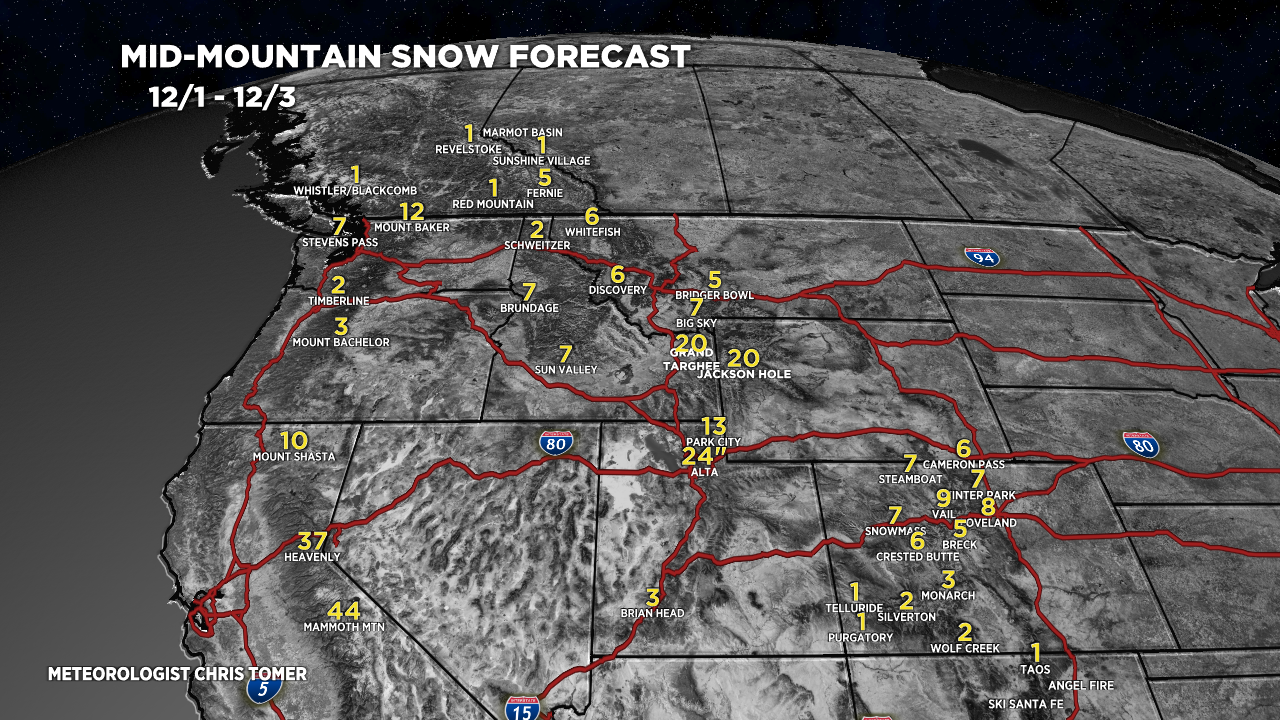
Storm #1.
Forecast snow totals (inches) valid 12/1-12/3.

Storm #2.
Forecast snow totals (inches) valid 12/4-12/7.

My forecast video 12/1:
Thanks Chris. Always a helpful forecast for making plans.
Anytime, Tim, thanks!