Tomer’s Take: Northeast storm system 11/25-11/26 trending much weaker with possible 2nd storm system 11/27-11/28.
- Northeast snow amounts continue trending lighter 11/25-11/26. Low pressure appears to be an open wave.
- Additional accumulation with 2nd storm system 11/27-11/28. This could be the stronger of the two storm systems.
- Larger pattern change for the West 11/25-12/1. Widespread snow and colder temps appear likely.
Current Setup
Infrared satellite shows two storm systems that degrade the high pressure ridge. The first low sneaks through 11/22-11/24. The 2nd low has a more a more profound effect across the West on/after 11/25.

Northeast Storm System
What a wild ride this forecast has been. The potential for a large storm system 11/25-11/26 is diminishing.
Forecast jet stream on 11/26. Note the initial storm system 11/25-11/26 is now merely an open wave. A second storm system might be more promising.

Forecast total snowfall (inches) valid 11/22-11/28.

Western Ridge Breaks Down
Forecast jet stream valid 11/29. Western ridge is replaced by a large trough with low pressure systems moving through. This would translate into widespread snow and colder temps.

Forecast Timing
Forecast radar/satellite valid 11/22-11/27.
Forecast Snowfall
Forecast snow totals (inches) valid 11/22-11/24.

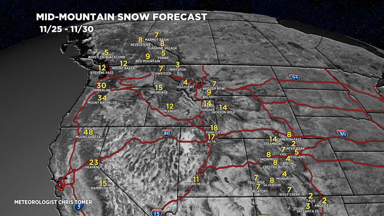
Forecast snow totals (inches) valid 11/25-11/30.

My forecast video 11/22:
What is the definition of an open wave?
Minor low pressure system that never reaches maturity. Chris