Tomer’s Take:
- No big storm cycles for the West until on/after 11/21.
- Current pattern includes high pressure ridge over PNW/BC/CA through 11/20. This is an anomalously strong Eastern Pacific high pressure ridge.
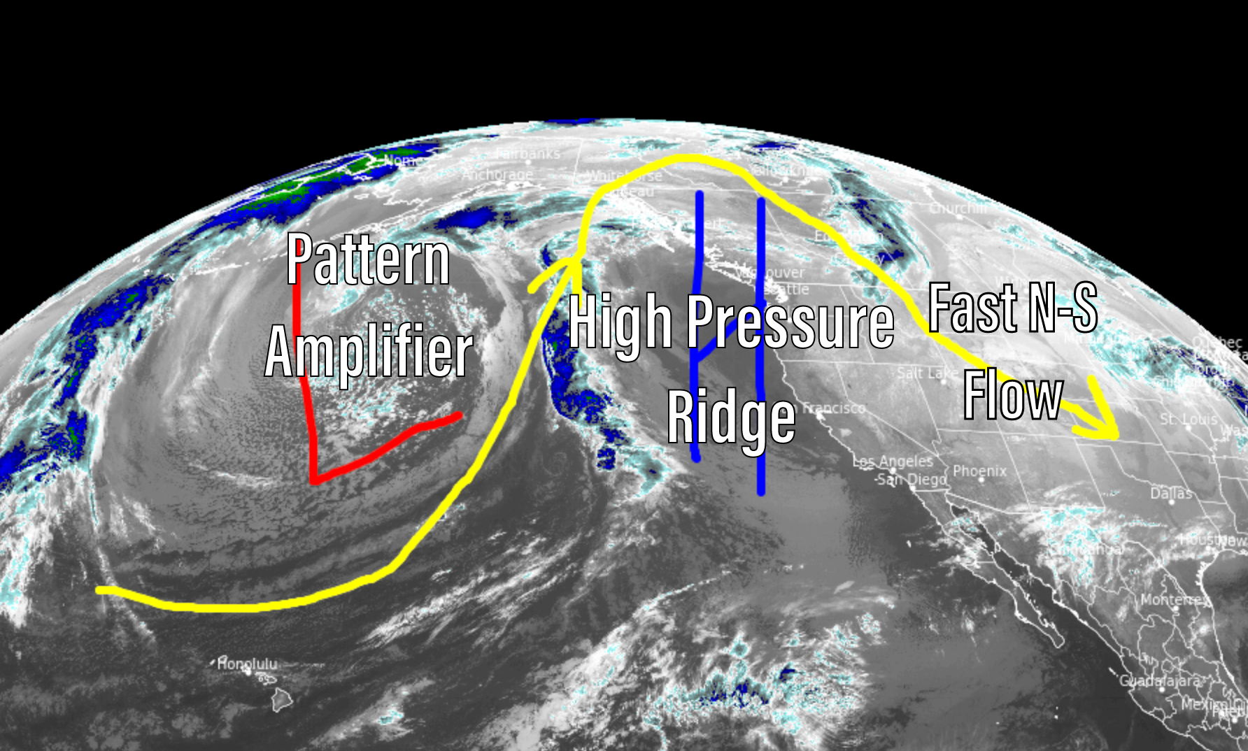
- Fast N-S jet flow favors Banff, MT, WY, CO, NM for light snow accumulation with cold fronts. Next front races north to south 11/16-11/18.
- On/after 11/21 the pattern shifts and precipitation returns to the PNW/BC, ID, MT, WY, UT, CO. Uncertain whether snow makes it further south into CA.
Current Setup
Infrared satellite shows the storm track and big players in the forecast. This pattern stays in place until 11/20 then changes on/after 11/21.
Of note is the strength of the high pressure ridge over the Eastern Pacific. It’s currently 3+ standard deviations above the norm.

Pattern Shift
Forecast jet stream flow valid 11/23 shows the high pressure ridge replaced by a powerful NW-SE jet stream.
Notice downstream effects in ID, WY, UT, and CO with WNW flow on/after 11/21.

Forecast Timing
Forecast radar/satellite 11/15-11/20.
Forecast Snowfall
Forecast snow totals (inches) valid 11/15-11/17.

Forecast snow totals (inches) valid 11/18-11/23.

My forecast video 11/15: