Tomer’s Take:
- Pattern is now in transition. A low slides down the West Coast but it weakens and dries up with only light mountain snow accumulation.
- This low becomes a weak southern track low that slides through the southern tier of the Rockies through 11/14. Behind it the pattern changes quickly to a high pressure ridge in the PNW/BC and large trough across the Intermountain West.
- This is a colder, drier pattern overall with only light snow accumulation.
- Bottom line: No big storm cycles on the short-term horizon.
- What about the end of November? Pattern appears to turn slightly more active for the West. This could last into early December. But, the overall signal is weak.
Current Setup
Infrared satellite shows the first low moving through the PNW and headed south into CA. It will weaken as it moves with only light snow accumulation. It then becomes a weak southern track low.
The 2nd low pressure slides into AK/Canada.

Mid November Pattern
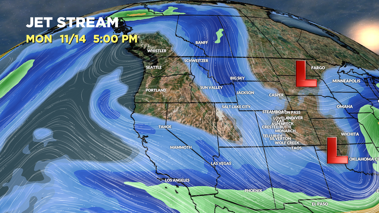
Forecast jet stream flow valid 11/14 illustrates the PNW/West Coast high pressure ridge. You can also see the southern track low with some southern branch support, but overall it’s weak.

Forecast jet stream valid 11/17 shows a progressive west to east flow with larger high pressure ridging. Lack of amplification means no big storm systems.

What about late November?
Some data suggest a slightly more active pattern for the West and West Coast. This could last into early December. But, the overall signal is weak.
Forecast Timing
Forecast radar/satellite valid 11/11-11/16.
Forecast Snowfall
Forecast snow totals (inches) valid 11/11-11/15.

Forecast snow totals (inches) valid 11/16-11/18.
