Tomer’s Take: I’m forecasting three different storm systems through 4/7 with deep snow bullseyes in CA, ID, WA, OR, MT, WY, UT, CO.
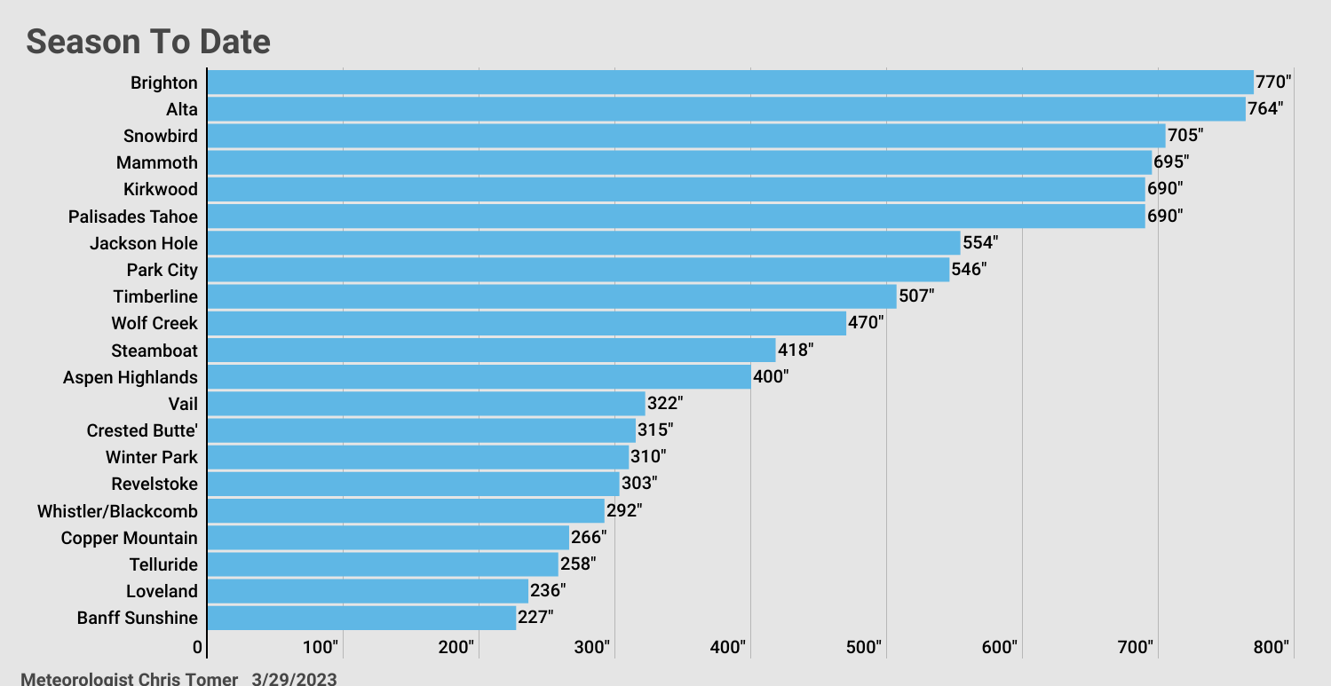
Season To Date Snowfall
A number of these totals are all-time records. The race to 800″ is on.

Current Setup
Water vapor satellite shows the powerhouse area of low pressure hitting CA and two additional storm systems lined-up. Orange/red = drier air aloft.

Forecast Pattern
Forecast jet stream valid 4/7. Notice the trough and area of low pressure across the West.

Jackson Hole, WY
3/29: Late 3″
3/30: 6″
3/31: 4″
4/1: 4″
4/2: 10″
4/3: 10″
4/4: 3″
4/5: 10″
4/6: 8″
4/7: 3″
Brighton, UT
3/29: Late 3″
3/30: 6″
3/31: 6″
4/3: 12″+
4/5: 1″
4/6: 1″
4/7: 1″
Forecast Totals
3/29-3/31:

4/1-4/7:

3/30-4/7:

Mammoth has 870” at the summit. The 675” is from a lodge base depth!
Yes!
Long live the winter of 22/23!
And it’s still going!
NWS fail today. Not even a winter weather advisory. I live in Summit County near Buffalo Mtn trailhead and certainly having the most energetic winter storm of the season. Maybe 8” so far and heavy winds with temps in the mid-teens.