Tomer’s Take: California’s Sierra continues to get nailed by a strong storm system, a moderate atmospheric river (AR), and solid orographics. Next stop for big totals are ID, UT, WY, CO 12/11-12/14.
- I was alerted to heavy snowfall at Sunshine Village between 12/7-12/9 of about 20 inches. This is more than what I was forecasting. Curious as to how it occurred. I’ll look into the pattern.
Current Setup
Visible satellite shows the big low pressure hitting California.

Here’s a zoom. The size is impressive!

Forecast Pattern
Forecast jet stream valid 12/11/2022.

Forecast jet stream valid 12/12/2022. Look at the size of the trough and ejection.

Forecast jet stream valid 12/13/2022. The main low ejects and the 2nd low is meandering through the Pacific with little impact.

Forecast jet stream valid 12/18. A quiet period for the West with in-between jet flow. The northern and southern jet branches are split and running parallel.

Forecast Timing
Forecast radar/satellite valid 12/10-12/15.
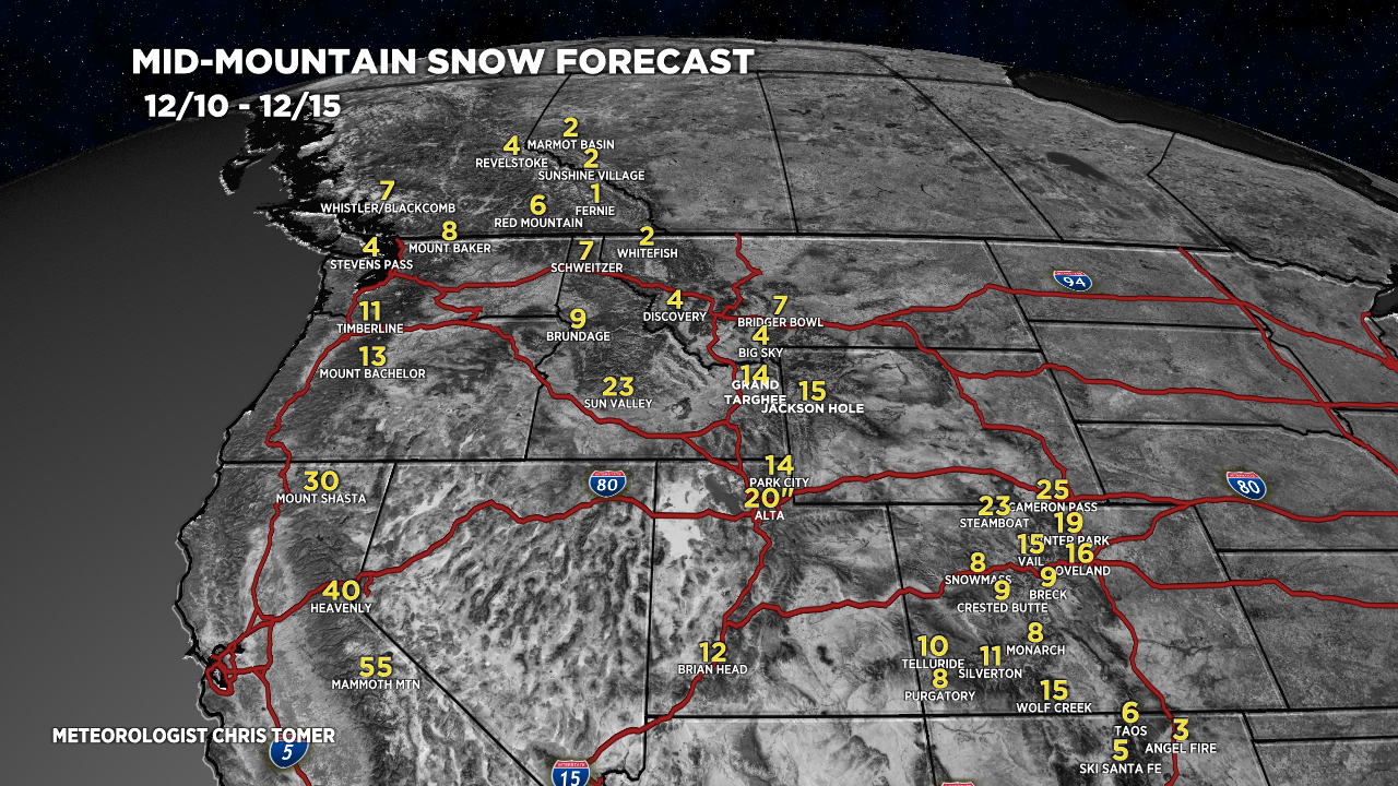
Forecast Totals
Forecast snow totals (inches) valid 12/10-12/15. The heavy snow in Colorado occurs over the course of 3-4 days (so it’s not all at once).

Forecast snow totals (inches) valid 12/16-12/18. A much quieter period in-between jet flow.

My forecast video: