Tomer’s Take: 4-5 different waves of moisture hit the PNW/BC 2/3-2/9 with four feet of accumulation or more. A storm system on/after 2/5 delivers snow to CA, ID, MT, WY, UT, and CO. A 2nd storm system follows a similar track 2/8-2/9. A 3rd storm system hits the West Coast on/around 2/11.
My forecast video 2/2:
Current Setup
Infrared satellite shows the storm track establishing itself with a rich feed of moisture and conveyor belt of storm systems lined-up for the PNW/BC.

Forecast Pattern
Forecast jet stream valid 2/11. A large trough hits the West Coast.

Forecast Timing
Forecast radar/satellite valid 2/2-2/7.
Mount Baker
Forecast totals and timing:
2/3: 11″
2/4: 6″
2/5: 6″
2/6: 11″
2/7: 14″
2/8: 12″
2/9: 2″
Forecast Totals
Forecast snow totals (inches) valid 2/2-2/4.

Forecast snow totals (inches) valid 2/5-2/11.

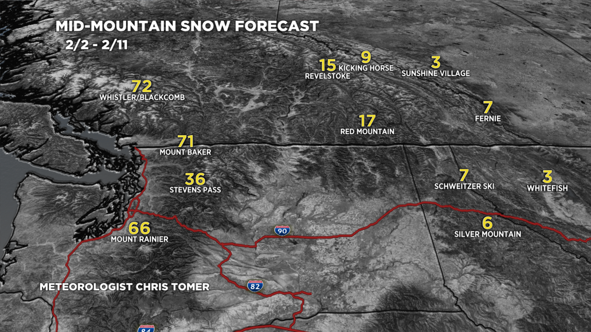
Forecast snow totals (inches) valid 2/2-2/11.

Forecast snow totals (inches) valid 2/2-2/11.
