Tomer’s Take: Two atmospheric river surges will push the rain/snow line to 7,000-8,500ft in the Sierra. The biggest snow totals occur above this level. Heavy overrun snowfall occurs in UT, CO, WY.
Tahoe Rain/Snow Line
3/9: Up to 8500ft
3/10: Up to 8000ft
3/11: Up to 7100ft
3/12: Up to 7200ft
3/13: Up to 8000ft
3/14: Up to 7100ft
Current Setup
Water vapor satellite shows the Pineapple Express. Orange/red = drier air aloft.

Forecast Pattern
Forecast jet stream valid 3/11. The jet W-E orientation establishes the Pineapple Express reaching all the way west to Hawaii.

Atmospheric River
Forecast GEFS Integrated Vapor Transport (IVT) next 10 days. Notice the two moderate to strong intensity surges.

Forecast Timing
Forecast radar/satellite valid 3/9-3/14:
Kirkwood, CA
3/9: Late 13″
3/10: 30-40″
3/11: 10-12″
3/12: 6″+
3/13: 20″
3/14: 20-30″
Forecast Totals
3/9-3/11:

3/12-3/18:

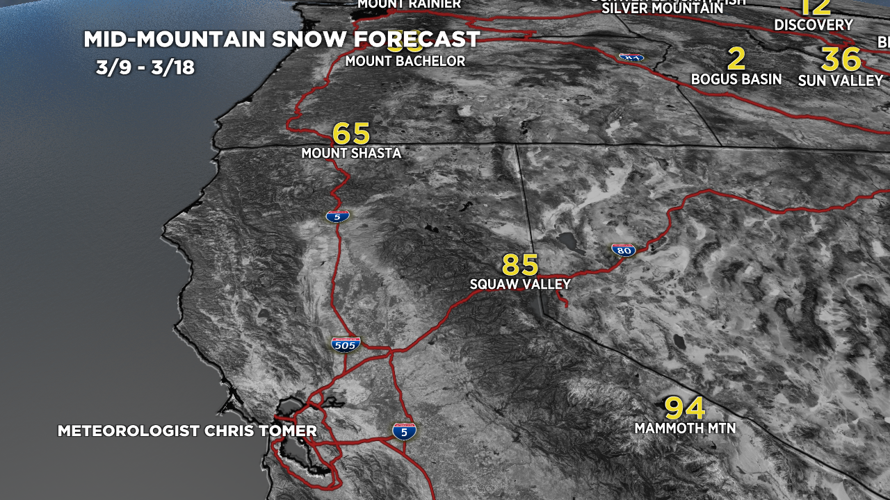
3/9-3/18:

3/9-3/18:

3/9-3/18:

3/9-3/18:

3/9-3/18:
VT/NH/ME Key Snow Dates:
3/13: Late 6″
3/14: 10-12″
3/15: 1-2″
