Tomer’s Take: Pattern remains active for parts of the West through the end of March. Steady snow accumulation is likely in the Sierra 3/19-3/25 then the pattern shifts north favoring the Pacific Northwest and Northern Tier of States.
Season Totals So Far:

Mammoth’s All-Time Record at the Main Lodge (Base) is 668″ set in 2010-2011. Summit total is currently 778″.
Forecast Pattern
Forecast jet stream valid 3/25. An area of low pressure slides through the Intermountain West.

Forecast Timing
Forecast radar/satellite valid 3/16-3/21.
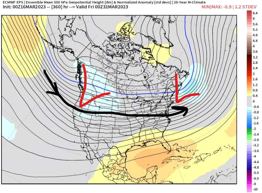
End of March Pattern
Forecast mid-atmosphere pressure anomalies valid 3/30. Overall pattern favors the PNW/Northern Tier of states for unsettled weather.

Forecast Tahoe Rain/Snow Line
3/19: 7200′
3/20: 7100′
3/21: 5800′
Forecast Totals
3/16-3/18:

3/19-3/25:

3/16-3/25:
