Tomer’s Take: Freezing levels fall today (4/13) through 4/15 then start rising again with warmer air. Storm track favors PNW/BC/Northern Tier through 4/24 then uncertainty.
One more photo of the dirty snowpack in Colorado…it’s a good one from Nick Green while skiing in Aspen, CO. Thanks Nick!
My blog post yesterday explains this phenomena.

Forecast Freezing Level
Wasatch, Maximum Height:
4/13: 6100′
4/14: 7100′
4/15: 9500′
4/16: 11700′
4/17: 11300′
4/18: 7200′
Colorado’s Central Mountain Zone, Maximum Height:
4/13: 12300′
4/14: 9700′
4/15: 8500′
4/16: 11900′
4/17: 13000′
4/18: 11900′
Forecast Pattern
Forecast jet stream valid 4/22. Northern branch remains active for the PNW/BC/Northern Tier.

Forecast Pattern Late April
Forecast GEFS mid-atmosphere pressure anomalies valid 4/24. This data keeps the unsettled pattern entrenched across the PNW/BC/Northern Tier through 4/24.

Forecast GEFS mid-atmosphere pressure anomalies valid 4/28. This data washes-out the PNW trough and replaces it with a small amount of high pressure ridging across the West.

Forecast Timing
Forecast radar/satellite valid 4/13-4/18.
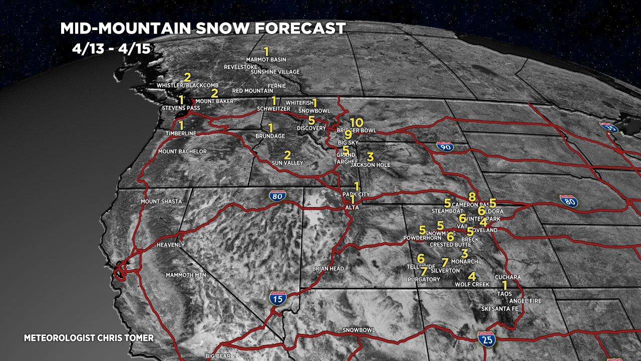
Forecast Totals
4/13-4/15:

4/16-4/22:
