Tomer’s Take: The place to be through Christmas is the PNW, BC, Banff, ID, MT, WY, UT, CO where an Arctic front will direct the pattern. In the Northeast, the Western Arctic front develops into a large low pressure on/around 12/23. Unfortunately, it looks too warm with snow to rain then back to snow.
My forecast video 12/18:
Current Setup
Visible satellite shows a quiet Western pattern for now. Notice the blue Arctic front diving south from Canada. That front then connects to the large low pressure over the Pacific.

Forecast Pattern
Forecast jet stream pattern valid 12/19. The Arctic front is diving south from Canada.

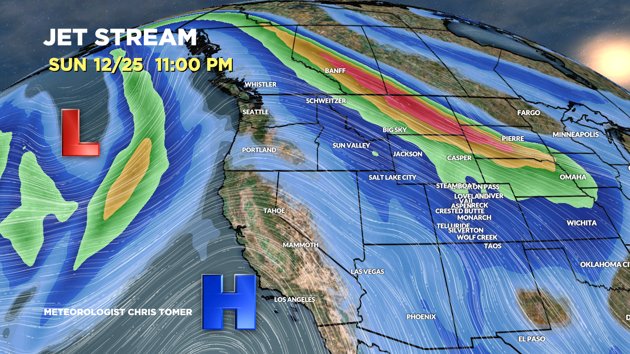
Forecast jet stream pattern valid 12/25. Notice the N to S jet stream from the upper reaches of Canada through MT, WY, and CO.

Forecast Timing
Forecast radar/satellite valid 12/18-12/23.
Forecast Totals
Forecast snow totals (inches) valid 12/18-12/20. Arctic front starting to make its move south.

Forecast snow totals (inches) valid 12/21-12/23. Arctic front drags snow North to South with high ratios.

Forecast snow totals (inches) valid 12/24-12/27. NW flow type setup favoring Banff, BC, MT, ID, WY, UT, and Central & Northern Mountains of Colorado.
Snow returns to California on/around 12/27.

Forecast snow totals (inches) valid 12/18-12/26. The bulk of this snow occurs on/around 12/23 but will be mixed with rain.

Hey Chris how about add Hunter mountain to your list. New York State has the most ski areas out of any state, Hunter could be the NY contingent 😁