Tomer’s Take: One more storm system is lined-up for CA and the West before the pattern shifts after 12/8.
- The remaining storm system is a little more ragged, a little weaker, and overall not as cold as storm #1.
- There is an additional storm system in the flow but it appears to hit further north in the PNW and then wash-out as the pattern shifts.
- The pattern shifts north after 12/8 favoring the PNW and northern tier of states through 12/12. Heavy snow accumulation likely.
Current Setup
Infrared satellite shows two storm systems lined-up. The first low delivers heavy snow accumulation to CA and the interior. The 2nd low hits further north and then might wash-out at the expense of a pattern shift.

Pattern through 12/12
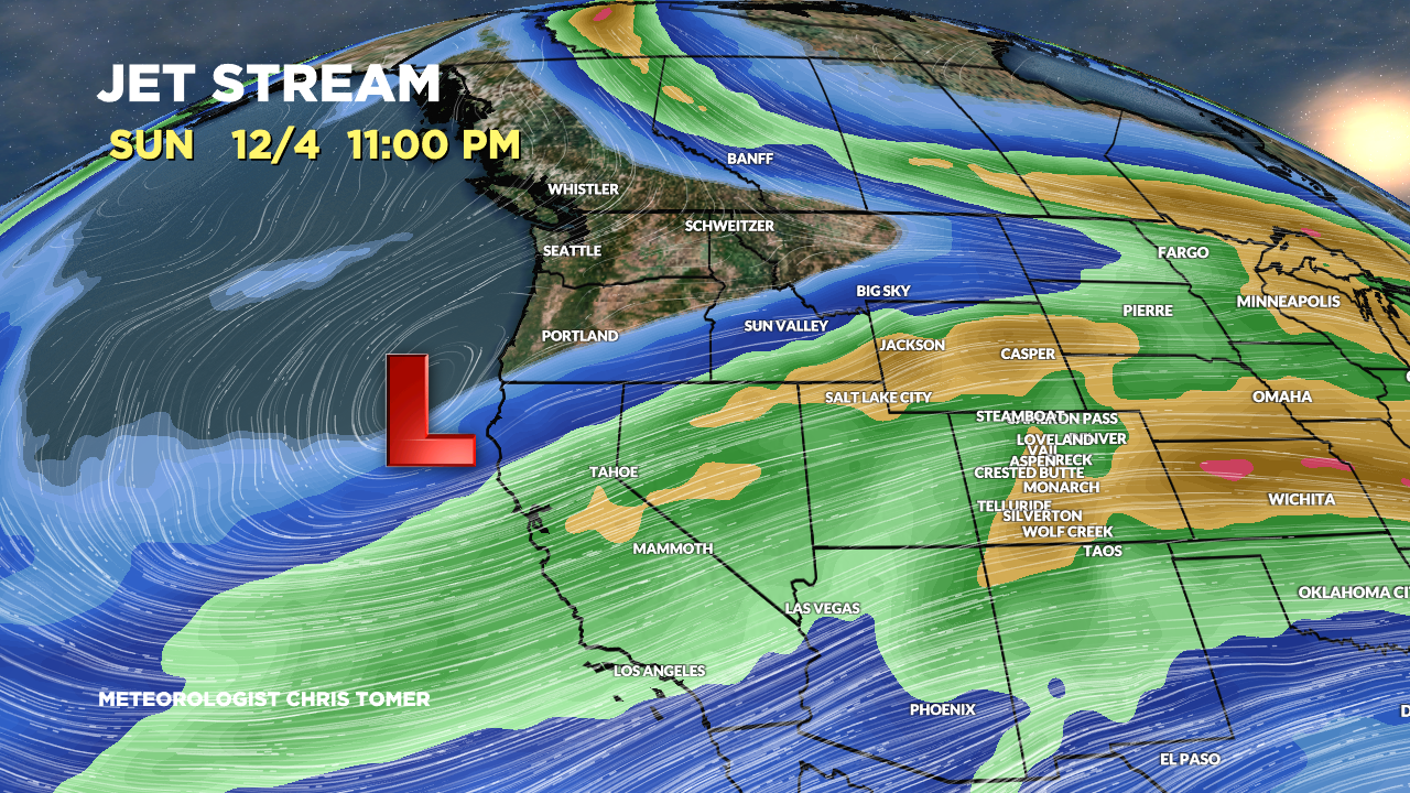
Forecast jet stream valid 12/4. Heavy snow is likely in the Sierra.

Forecast jet stream valid 12/7. The CA low is sliding through the interior Rockies. It’s not as cold as its predecessor and the flow is more ragged.

Forecast jet stream valid 12/12. The pattern has shifted north favoring the PNW, Banff, BC, and northern tier of states. This might setup a NW flow type pattern.

Forecast Timing
Forecast radar and satellite valid 12/3-12/8.
Forecast Totals
Forecast snow totals (inches) valid 12/3-12/7.

Forecast snow totals (inches) valid 12/8-12/10.

Forecast snow totals (inches) valid 12/3-12/10.

67″ at Mt Baker?? I’m headed there in a few days for an avalanche course….should be plenty of snow to assess, even if that turns out to be optimistic.
That’ll be a great course, Rob! Thinking 45″ at Baker by 12/12 based on what I’m seeing this morning. Chris