Tomer’s Take:
- PNW/Western BC/CA stay mostly dry through 11/20 with high pressure ridge.
- Then the pattern shifts on/after 11/21 as the high gets dislodged and lower pressures move into the PNW/BC with a powerful jet.
- Between 11/14-11/21 the Intermountain West stays active with fast-moving north to south cold fronts but only light snow accumulations. This favors Banff, MT, WY, CO, NM.
Please subscribe to my YouTube channel. It features a daily mountain weather forecast video and commentary.
My forecast video 11/14:
Current Setup
Infrared satellite shows the storm track, high pressure building into the PNW, and powerful low tracking into AK. This low will reinforce the high pressure ridge across the PNW/BC/CA through 11/20 before the pattern changes.

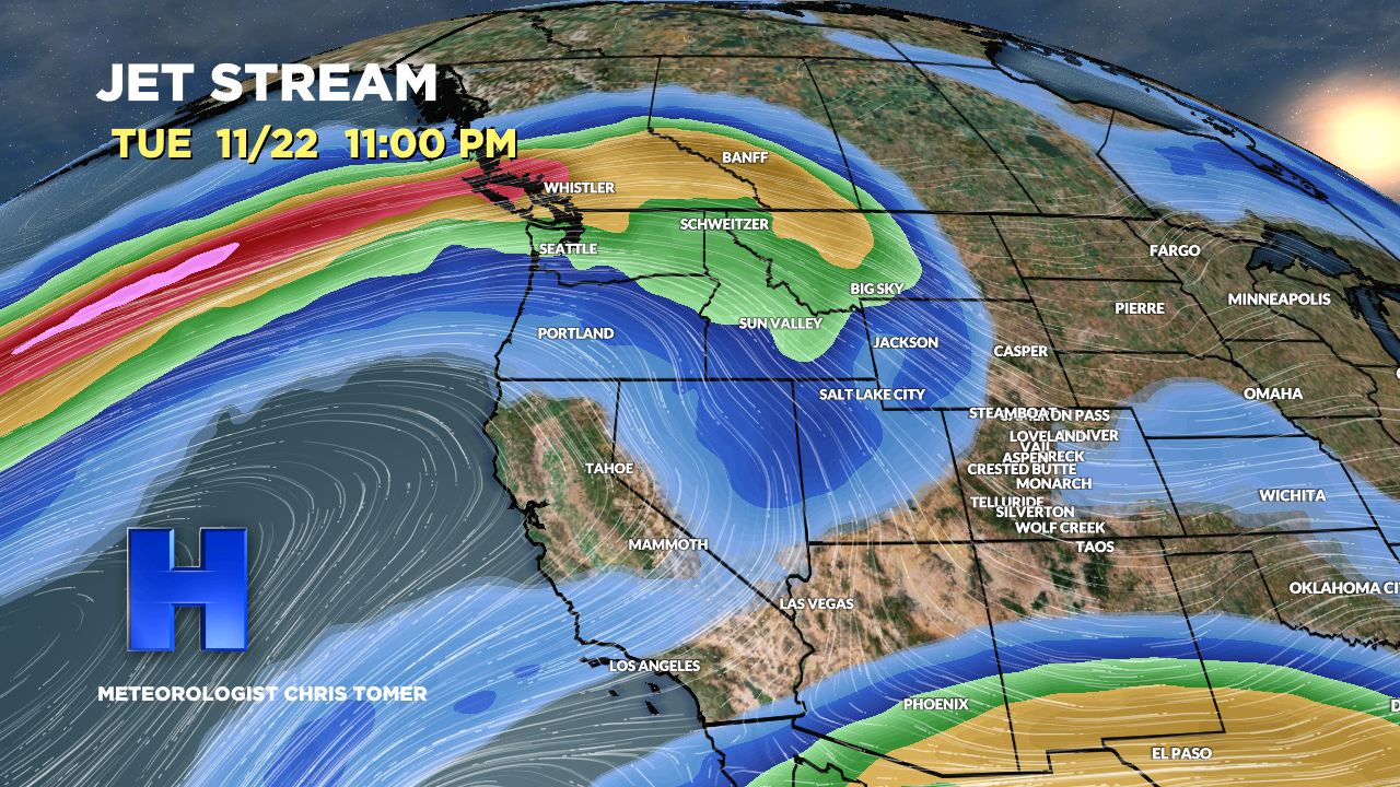
Pattern Change On/After 11-21
Forecast jet stream flow valid 11/16. Notice the high pressure ridge draped across CA/PNW/BC and fast N-S flow from Banff to MT to WY to CO.

Forecast jet stream valid 11/22. Notice the high pressure ridge is gone from the PNW/BC and is replaced with a powerful jet stream/streak. This would translate into precipitation for the PNW/Banff/BC.

Forecast Timing
Forecast radar/satellite valid 11/14-11/19.
Forecast Snowfall
Forecast snow totals (inches) valid 11/14-11/16.

Forecast snow totals (inches) valid 11/17-11/22. The PNW/BC/CA snow occurs on/after 11/21.
